Do you have a question about the Fly Dragon FDG30 and is the answer not in the manual?
High efficiency, long endurance, and coverage details for the drone.
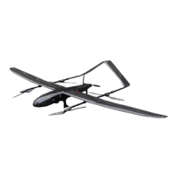
Features triple redundant flight control, advanced technologies, and safety features.
Eliminates ground control points and integrates high-accuracy GNSS RTK/PPK module.
Fast and simple camera switching, supporting a wide range of sensors.
Connect battery, initiate aircraft self-check, and sensor calibration.
Select 'Check' in the control bar and complete the pre-flight checklist.
A guide for successfully taking off the drone.
Place the aircraft, click 'Set landing point', and confirm with 'OK'.
Judge aircraft status, click 'Unlock' when ready, then proceed to take off.
Automatic vertical take-off after unlocking and a brief idling period.
Monitor flight status and control the drone via the ground station interface.
Procedures for the aircraft to return to the landing point and land vertically.
Steps involved in setting up an aerial survey mission.
Define the survey region using the GCS map or by importing a KML file.
Configure resolution, flight height, route angle, and overlap rates.
Generate the flight path automatically after setting survey parameters.
Save the configured aerial survey task or load an existing one.
Support for flying multiple independent survey areas within a single mission.
Plan large survey areas with extended flight times and return-to-home functions.
Save and load divided survey areas, allowing flexible task assignment.
Convert the UAV GCS mission into a KML file for Google Earth import.
Supplement mission data due to weather or other unforeseen factors.
Requirements for safe take-off and landing clearance areas.
Load previously saved tasks or plan new missions directly on-site.
Configure settings for takeoff and landing circle points.
Steps for VTOL UAV takeoff, including altitude adjustments and mode switching.
Procedures for landing the drone, including hover point settings.
| Brand | Fly Dragon |
|---|---|
| Model | FDG30 |
| Category | Drones |
| Language | English |