6.4.2 Accuracy Standard in Static Surveying
Accuracy standard in static surveying is judged by the rms of distance in the adjacent
two points.
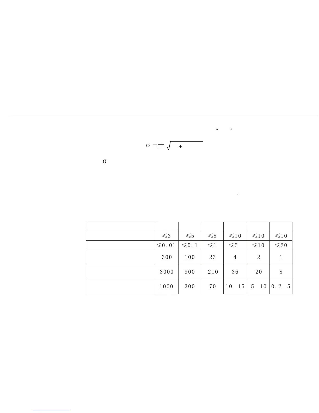
: fixed error (mm)
: scale factor (ppm) : distance (km)
The surveying accuracy for GPS is divided into 6 levels by Surveying Standard for GPS
published in 2001 (AA, A, B, C, D, E). AA, A, B are for country
s GPS control surveying.
Level C is mainly in engineering surveying of big or middle cities. D and E are for control
surveying in middle or small cities
A20 User Manual
40
Minimum distance for
Maximum distance for
Average distance for
Items
AA
A
B
C
D
E
Fixed error:a (mm)
Scale factor: b(ppm)
adjacent two points (km)
adjacent two points(km)
adjacent two points(km)
~ ~~