Item Wire Function Wire Color
À
NMEA 0183 internal port Rx (in) Brown
Á
NMEA 0183 internal port Tx (out) Blue
Â
Ground (power and NMEA 0183) Black
Ã
Power Red
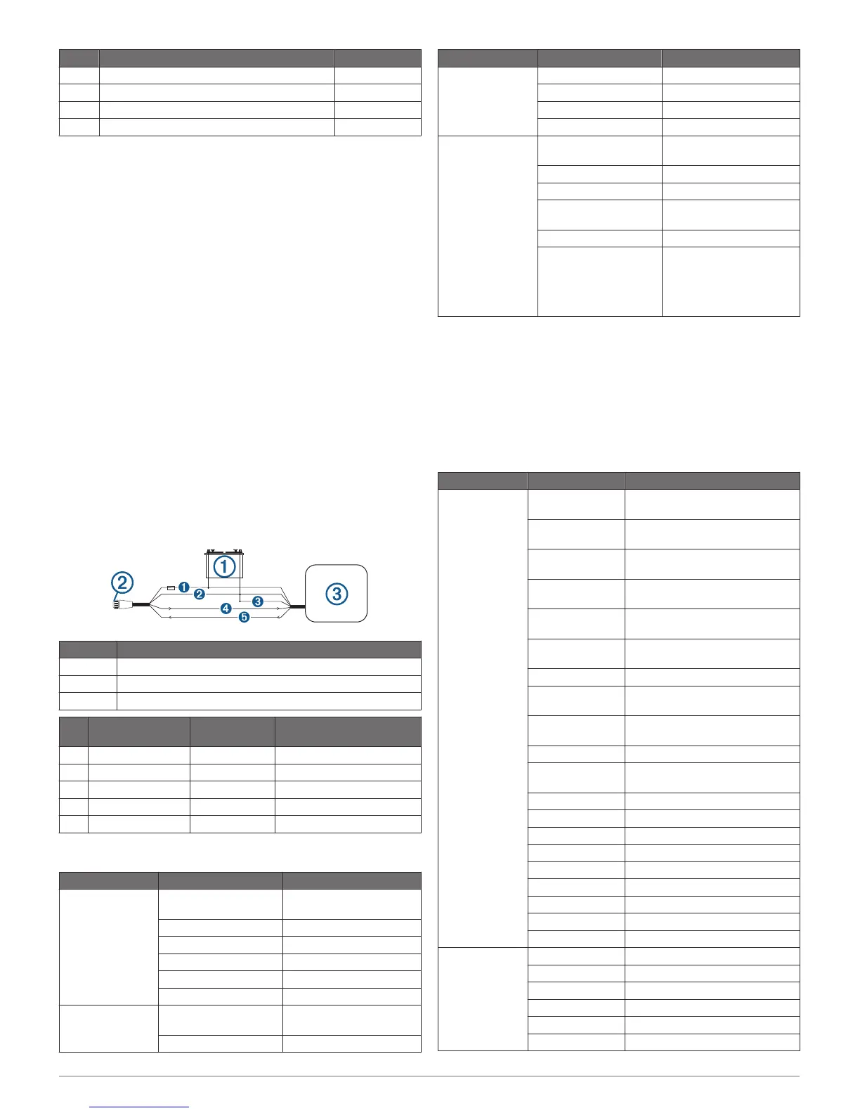
Connecting the Wiring Harness to Power
1
Route the wiring harness to the power source and to the
device.
2
Connect the red wire to the positive (+) battery terminal, and
connect the black wire to the negative (-) battery terminal.
NMEA 0183 Connection Considerations
• The installation instructions provided with your NMEA 0183
compatible device should contain the information you need to
identify the transmitting (Tx) and receiving (Rx) A (+) and B
(-) wires. Each port may have one or two transmitting wires,
or one or two receiving wires.
• When connecting NMEA 0183 devices to ports containing
two transmitting (Tx) wires or two receiving (Rx) wires each, it
is not necessary for the NMEA 0183 device to connect to a
common ground.
• When connecting a NMEA 0183 device to ports containing
one transmitting (Tx) wire or one receiving (Rx) wire each,
the
NMEA 0183 device must be connected to a common
ground.
• When the device is mounted in a location that prevents the
internal antenna from acquiring a satellite signal, you can
connect an external GPS 19x antenna through a NMEA 0183
connection. For more information, see the GPS 19x
Installation Instructions.
NMEA 0183 Connection Diagram
Item Description
À
12 Vdc power source
Á
Wiring harness
Â
NMEA 0183 compliant device
Item Garmin Wire
Function
Garmin Wire
Color
NMEA 0183 Device Wire
Function
Ê
Power Red Power
Ë
Ground Black Data ground
Ì
Tx/Rx Tx/Rx/B (-)
Í
Tx Blue Rx/A (+)
Î
Rx Brown Tx/A (+)
Specifications
Device Specification Measurement
echoMAP CHIRP
40
Dimensions (W x H x
D)
10.2 x 16.8 x 4.6 cm (4 x
6.6 x 1.8 in.)
Display size (W x H) 5.4 x 9.5 cm (2.1 x 3.7 in.)
Weight 0.4 kg (0.9 lbs.)
Power input From 9 to 18 Vdc
Max. power usage 5 W
Compass-safe distance 25 cm (9.8 in.)
echoMAP CHIRP
50
Dimensions (W x H x
D)
17.3 x 13.5 x 4.4 cm (6.81
x 5.35 x 1.73 in.)
Display size (W x H) 9 x 9 cm (3.54 x 3.54 in.)
Device Specification Measurement
Weight 0.58 kg (1.28 lbs.)
Power input From 9 to 18 Vdc
Max. power usage 7.1 W
Compass-safe distance 70 cm (27.6 in.)
All Models Temperature range From -15 to 55°C (from 5
to 131°F)
Material Polycarbonate plastic
Water rating* IEC 60529 IPX7
Transmit power
(RMS)**
500 W
Maximum depth*** 701 m (2,300 ft) at 77 kHz
Frequencies**** • CHIRP Traditional: 50,
77, 83, or 200 kHz
• CHIRP Garmin
ClearVü: 260, 455, or
800 kHz.
*The device withstands incidental exposure to water of up to 1 m
for up to 30 min.
**Dependent upon transducer rating and depth.
***Maximum depth, dependent upon transducer, water salinity,
bottom type, and other water conditions.
****Dependent upon echoMAP model.
NMEA 0183 Information
Type Sentence Description
Transmit GPAPB APB: Heading or track controller
(autopilot) sentence "B"
GPBOD BOD: Bearing (origin to
destination)
GPBWC BWC: Bearing and distance to
waypoint
GPGGA GGA: Global positioning system
fix data
GPGLL GLL: Geographic position
(latitude and longitude)
GPGSA GSA: GNSS DOP and active
satellites
GPGSV GSV: GNSS satellites in view
GPRMB RMB: Recommended minimum
navigation information
GPRMC RMC: Recommended minimum
specific GNSS data
GPRTE RTE: Routes
GPVTG VTG: Course over ground and
ground speed
GPWPL WPL: Waypoint location
GPXTE XTE: Cross track error
PGRME E: Estimated error
PGRMM M: Map datum
PGRMZ Z: Altitude
SDDBT DBT: Depth below transducer
SDDPT DPT: Depth
SDMTW MTW: Water temperature
SDVHW VHW: Water speed and heading
Receive DPT Depth
DBT Depth below transducer
MTW Water temperature
RMC/GGA/GLL GPS position
VHW Water speed and heading
WPL Waypoint location
5
 Loading...