EasyManuals Logo

Garmin eTrex 20 User Manual

Garmin eTrex 20
168 pages
To Next Page IconTo Next Page
To Previous Page IconTo Previous Page
Page #63 background imageLoading...
Page #63 background image
คู่มือการใช้งานสำาหรับรุ่น 10, 20, 30
61
TH
Waypoints เส้นทาง และ Tracks
การหา waypoint
1. เลือก ค้นหาตำาแหน่ง >
Waypoints
2. เลือกหนึ่ง waypoint
การแก้ไข Waypoint
ก่อนที่จะสามารถแก้ไข waypoint คุณ
ต้องสร้าง waypoint ขึ้นมาก่อน
1. เลือก จัดการ waypoint
2. เลือกหนึ่งจุด waypoint
3. เลือกรายการที่ต้องการแก้ไข
4. ป้อนข้อมูลใหม่
5. เลือก เสร็จ
การลบ waypoint
1. เลือก จัดการ waypoint
2. เลือกหนึ่งจุด waypoint
3. เลือก menu > ลบ > ใช
การเพิ่มความแม่นยำาของตำาแหน่ง
waypoint
การเฉลี่ย Waypoint ช่วยคุณในการเพิ่ม
ความแม่นยำาของตำาแหน่ง waypoint
ได้ โดยการเก็บตัวอย่างตำาแหน่ง
waypoint หลายตำาแหน่ง
1. เลือก การเฉลี่ย Waypoint
2. เลือกหนึ่งจุด waypoint
3. เคลื่อนไปยังตำาแหน่ง
4. เลือก เริ่มต้น
5. เมื่อแถบสถานะ Sample
Condence ขึ้นถึง 100% ให้เลือก
จัดเก็บ สำาหรับผลลัพธ์ที่ดีที่สุด ให้
เก็บตัวอย่าง waypoint สี่ถึงแปด
ตัวอย่าง โดยรออย่างน้อย 90 นาที
ระหว่างเก็บตัวอย่าง
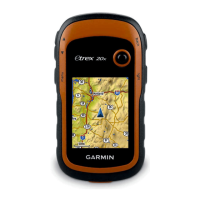
Table of Contents

Other manuals for Garmin eTrex 20

Questions and Answers:

Garmin eTrex 20 Specifications

General IconGeneral
Outdoor (hiking, trekking)Yes
Marine (chartplotters, sounders)No
Routes quantity200
Number of waypoints2000
Form factorHandheld
Display diagonal2.2 \
Display resolution176 x 220 pixels
Display number of colors65536 colors
Display size (HxV) (imperial)1.7 x 1.4 \
Internal memory1740 MB
USB 2.0 ports quantity1
Battery typeAA
Battery life (max)25 h
Battery technologyNickel-Metal Hydride (NiMH)
Number of batteries supported2
Weight and Dimensions IconWeight and Dimensions
Depth33 mm
Width54 mm
Height103 mm
Weight141.7 g

Related product manuals