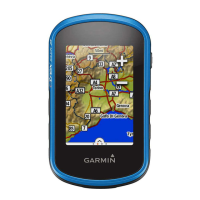
Do you have a question about the Garmin eTrex Touch 25 and is the answer not in the manual?
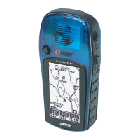
Describes the physical components and ports of the device.
Steps to start and stop recording your path or activity.
Options to adjust how track data is displayed and recorded.
Procedures for saving the active track log.
Procedures for saving a specific location as a waypoint.
How to locate saved waypoints on the device.
Modifying the details of an existing waypoint.
Steps to plan and build a sequence of points for navigation.
Modifying the points or order of an existing route.
Removing saved routes from the device.
Instructions for transferring data between the device and BaseCamp.
How to search for destinations based on proximity.
Guidance on setting and starting a route to a chosen destination.
Using the on-screen map for directional guidance.
Utilizing the compass for directional cues.
Adjusting the altimeter for accurate pressure readings.
Transferring geocache data from a PC to the device.
Finding geocaches stored on the device.
Sharing data between compatible devices via ANT+.
Creating alerts for reaching specific locations.
Steps for tracking running or cycling activities.
Instructions for uploading activity data to Garmin Connect.
Adding, removing, or rearranging app icons.
Modifying screen brightness to conserve battery or improve visibility.
Adjusting how responsive the touchscreen is.
Choosing between different saved device configurations.
Setting up personalized device configurations for activities.
Choosing between GPS, GPS+GLONASS, or Demo Mode.
Explains the benefits and trade-offs of using GPS and GLONASS.
Technical details including battery type, life, and water rating.
Information on accessing Garmin support and software updates.
Instructions for installing and using Garmin Express software.
How to reboot the device if it becomes unresponsive.
Information about the ANT+ wireless temperature sensor.
| Sport (fitness, running) | Yes |
|---|---|
| Marine (chartplotters, sounders) | - |
| Map coverage | Western Europe |
| Display diagonal | 2.6 \ |
| Display resolution | 160 x 240 pixels |
| Display number of colors | 65536 colors |
| Built-in camera | No |
| Battery type | AA |
| Power source type | Battery |
| Battery life (max) | 16 h |
| Battery technology | Nickel-Metal Hydride (NiMH) |
| Number of batteries supported | 2 |
| Compatible memory cards | MicroSD (TransFlash) |
| Internal storage capacity | 8 GB |
| Routes quantity | 200 |
| Number of waypoints | 4000 |
| Form factor | Handheld |
| Product color | Black, Blue |
| International Protection (IP) code | IPX7 |
| Cables included | USB |
| Depth | 33 mm |
|---|---|
| Width | 58 mm |
| Height | 102 mm |
| Weight | 159 g |