Do you have a question about the Garmin ETREX H and is the answer not in the manual?
Information on how to contact Garmin for support via phone or web.
Instructions for online product registration to improve user support.
Information on available accessories for the eTrex device.
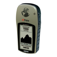
Identifies and describes the device's physical components and controls.
Instructions for installing batteries and attaching the lanyard to the device.
Explains basic operational terms like Select, Key, Field, Scroll bar, and Default.
Explains how to follow instructions and navigate menus in the manual.
Details the functions of the UP/DOWN, ENTER/MARK, and QUIT/PAGE keys.
Instructions on how to power the device on and off.
How to adjust backlight timeout and screen contrast.
How to navigate menus, select options, and enter data on the device.
Explains how the device displays important operational messages.
Displays GPS receiver status and satellite signal strength.
Options to adjust display contrast and backlight timeout.
Shows current location, destination, and track log on a map.
Options to orient the map and auto-zoom settings.
Option to hide waypoint symbols and names on the map.
Displays course or bearing line to the destination.
Stops active navigation.
Guides to a destination with distance, time, and direction.
Resets speed, trip data, and stops navigation.
Displays travel information like odometers and speed.
Accesses advanced features, waypoints, routes, and setup.
How to create a waypoint at current or specified location.
Edit waypoint names, view nearest, and delete all waypoints.
Procedures to cease active navigation to a destination.
Lists best times for activities and celestial event times.
Detailed steps for creating a waypoint using projection.
Guides navigation through a sequence of waypoints.
Steps to select waypoints and form a navigation route.
How to start navigation along a pre-defined route.
Inserting or removing waypoints within an existing route.
Records and displays travel path data including time and position.
Manage track logs: save, clear, display on map.
Rename saved tracks and initiate TracBack navigation.
Delete tracks and configure track recording options.
Configure system modes, language, and time settings.
Adjust time format, time zone, and daylight saving time.
Adjust backlight timeout and screen contrast.
Set position format, map datum, and distance/speed units.
Configure map grid orientation and view north reference variance.
Set angle units, interface settings, and data exchange formats.
Configure communication formats and select operating modes.
Select user language and view software version.
Technical details of the eTrex H device, including physical and performance specs.
Supported interface formats and connection instructions to a PC.
Lists approved NMEA 0183 and Garmin proprietary data sentences.
How the device accepts DGPS corrections via RTCM format.
Terms and conditions for using the device software.
Garmin's declaration of product compliance with EU directives.
| Outdoor (hiking, trekking) | Yes |
|---|---|
| Marine (chartplotters, sounders) | No |
| Routes quantity | 20 |
| Number of waypoints | 500 |
| Form factor | Handheld |
| Certification | RoHS |
| Interface | Serial RS-232 |
| Display resolution | 64 x 128 pixels |
| Battery type | AA |
| Battery life (max) | 17 h |
| Number of batteries supported | 2 |
| Depth | 51 mm |
|---|---|
| Width | 112 mm |
| Height | 30 mm |