Do you have a question about the Garmin eTrex Summit and is the answer not in the manual?
Instructions for registering your eTrex Summit for product support and updates.
Important safety warnings and cautions for using the eTrex Summit device.
Information regarding the eTrex Summit's compliance with FCC regulations.
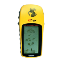
Description of the eTrex Summit's key features, including GPS, compass, and altimeter.
Identification and function of all physical buttons on the eTrex Summit device.
Detailed description of the eTrex Summit's physical components and external ports.
Instructions for installing batteries and expected battery life for the eTrex Summit.
Steps to turn on the unit and achieve a ready-to-navigate status.
Procedure for calibrating the eTrex Summit's electronic compass for accurate readings.
Overview of the five main pages: SkyView, Map, Pointer, Elevation, and Menu.
How to use the Map Page for navigation and tracking your path.
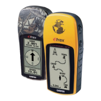
Using the Pointer Page for destination guidance and bearing information.
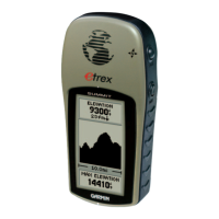
Understanding and using the Elevation Page for altitude data and profiles.
Accessing advanced features and settings via the Menu Page.
How to mark your current location as a waypoint for later return.
How to change the name, symbol, and elevation of a waypoint.
Using the Pointer Page to navigate to a destination using GOTO.
How to stop an active GOTO navigation session and clear the map display.
Customizing display settings and advanced view options for the SkyView Page.
Detailed satellite information and orientation options on the Advanced SkyView Page.
Customizing map display, auto-zoom, and waypoint visibility on the Map Page.
Using Sight 'N Go, Set Course, and other Pointer Page features.
Customizing elevation profile plots over time or distance.
Changing the user-selectable data fields displayed on the Elevation Page.
Creating, changing symbols, names, and elevations for waypoints.
Organizing, viewing nearest, and deleting all waypoints.
Deleting, viewing on map, or starting GOTO from a waypoint.
Creating a new waypoint based on distance and bearing from an existing one.
Methods for navigating: GOTO, Route, and TracBack.
Building routes by selecting waypoints or using MapSource.
Removing individual waypoints from a route list.
Understanding track logs and the TracBack navigation feature.
How to save, rename, and view track logs on the eTrex Summit.
Deleting saved track logs and using TracBack for navigation.
Tips for recalibrating the electronic compass after battery changes.
Manually calibrating the altimeter using elevation or pressure.
Overview of customizable settings available on the Setup Page.
Setting time format, time zone, and daylight savings time.
Adjusting backlight timeout and display contrast on the Display Page.
Setting units for distance, speed, elevation, pressure, and angle.
Selecting input/output formats for connecting with other devices.
Switching between GPS and compass heading based on speed.
Setting the orientation reference (True North, Magnetic North).
Configuring GPS mode, compass, altimeter, language, and software.
Technical specifications for the eTrex Summit device.
Explanation of how the Global Positioning System (GPS) works.
Tips for improving satellite signal reception.
Chart for determining UTC time offsets for various longitudinal zones.
List of available accessories for the eTrex Summit.
Diagram illustrating eTrex Summit connector pinouts and interface.
Common issues and solutions for the eTrex Summit.
Answers to common user questions about the eTrex Summit.
Alphabetical listing of topics covered in the manual with page numbers.
Details of the GARMIN product warranty and service.
| Outdoor (hiking, trekking) | Yes |
|---|---|
| Marine (chartplotters, sounders) | No |
| Routes quantity | 20 |
| Number of waypoints | 500 |
| Form factor | Handheld |
| Product color | Gray |
| Interface | Serial |
| Grayscale levels | 4 |
| Display resolution | 64 x 128 pixels |
| Display size (HxV) (imperial) | 1.1 x 2.1 \ |
| Battery type | AA |
| Battery life (max) | 13 h |
| Number of batteries supported | 2 |
| Depth | 30 mm |
|---|---|
| Width | 51 mm |
| Height | 112 mm |
| Weight | 150 g |