EasyManuals Logo

Garmin eTrex Summit User Manual

Garmin eTrex Summit
73 pages
To Next Page IconTo Next Page
To Previous Page IconTo Previous Page
Page #16 background imageLoading...
Page #16 background image
14
Getting Started
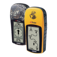
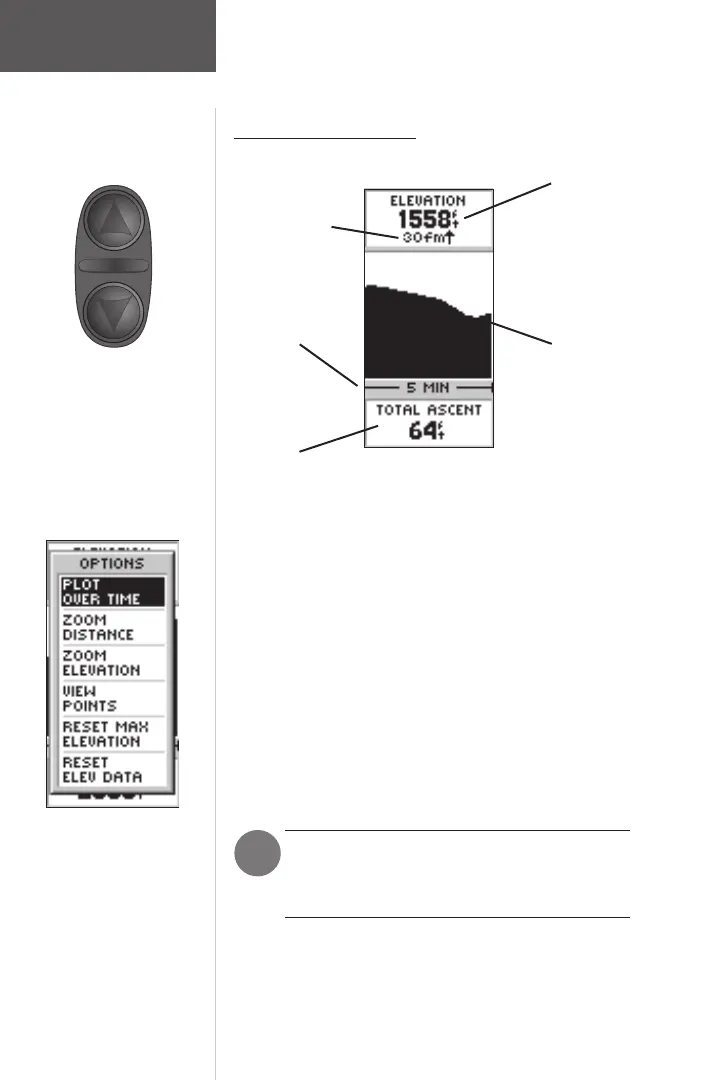
Elevation Page Basics
On the Elevation Page, the UP and
DOWN Buttons are used to cycle
through a variety of user-selectable
data.
Elevation
Profi le
Rate of
Ascent/Descent
Current
Elevation
Scale
The Elevation Page
Selectable
Data
The Elevation Page will provide the user with the
current elevation, rate of ascent/descent, and a profi le
of elevation changes over distance or time. The UP or
DOWN Buttons can be used to scroll through a variety
of user selectable data including Pressure, Vertical Speed,
Max Descent, Max Ascent, Avg Descent, Avg Ascent, Total
Descent, Total Ascent, Min Elevation, Max Elevation, and
12 Hour Pressure Trend.
The Altimeter should be calibrated for the
greatest accuracy. See page 42 for more infor-
mation on calibrating the Altimeter.
F
Press ENTER to access the
Elevation Page ‘OPTIONS’.
Page Basics
190-00193-00_0D.indd 02/12/01, 10:08 AM14

Other manuals for Garmin eTrex Summit

Questions and Answers:

Question and Answer IconNeed help?

Do you have a question about the Garmin eTrex Summit and is the answer not in the manual?

Garmin eTrex Summit Specifications

General IconGeneral
Outdoor (hiking, trekking)Yes
Marine (chartplotters, sounders)No
Routes quantity20
Number of waypoints500
Form factorHandheld
Product colorGray
InterfaceSerial
Grayscale levels4
Display resolution64 x 128 pixels
Display size (HxV) (imperial)1.1 x 2.1 \
Battery typeAA
Battery life (max)13 h
Number of batteries supported2
Weight and Dimensions IconWeight and Dimensions
Depth30 mm
Width51 mm
Height112 mm
Weight150 g

Related product manuals