18
Getting Started
Guidance by GARMIN
It is time to let the eTrex Summit guide you back to
the waypoint we named ‘HOME’ using the GOTO func-
tion. The GOTO function provides you with a straight
line navigation path to your selected destination.
To Start a GOTO:
1. Using the PAGE Button switch to the MENU Page.
2. Using the UP or DOWN Button, highlight ‘WAY-
POINTS’ and press ENTER. The WAYPOINTS Page
appears.
3. Using the UP or DOWN Button, select the tab
containing ‘HOME’ and press ENTER.
4. Using the UP or DOWN Button, select ‘HOME’ and
press ENTER. The REVIEW WAYPOINT Page appears.
5. Using the UP or DOWN Button, highlight ‘GOTO’,
and press ENTER.3
The Compass Page appears and you’re ready to begin
navigating!
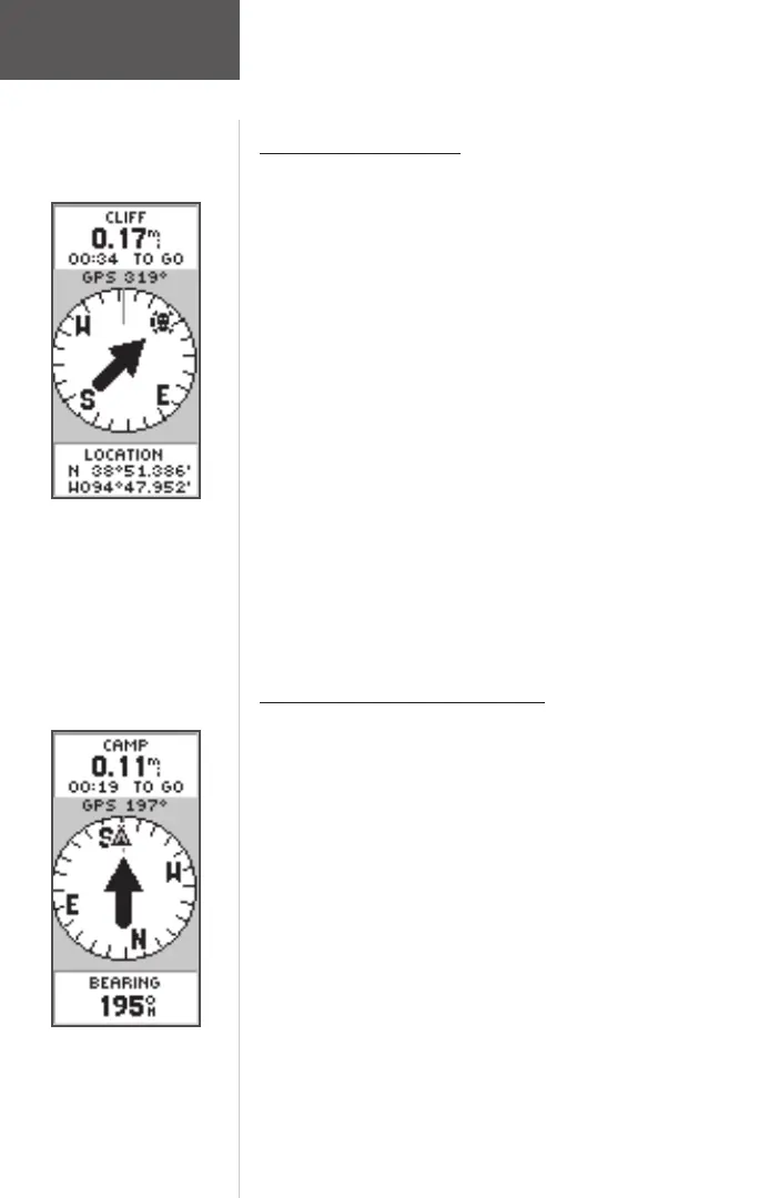
Heading in the Right Direction
The eTrex Summit will guide you back to where you
started using the Pointer Page. The pointer shows the
direction of the destination waypoint. Walk in the direc-
tion the arrow is pointing until the arrow points to the top
of the compass ring. If the arrow points to the right, you
need to go to the right. If the arrow points to the left, go
left. When the arrow is pointing straight up, you are on
the correct track!
The destination name, distance to the destination and
time to reach your destination are displayed at the top
of the screen. The sensor that is being used, Compass
or GPS, to determine your heading is displayed above
the pointer. The speed you are traveling is shown at
the bottom of the screen. Once you are getting close to
your destination, eTrex Summit will give you the message
“ARRIVING DESTINATION”.
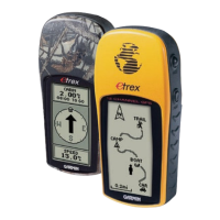
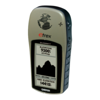
The pointer tells you what direc-
tion you should move. When the
pointer is pointing right, just
move right until the pointer is
pointing straight up and points
to the moving direction line (see
picture below).
When the pointer points straight
up as shown, you’re on track!
Follow the
Pointer
190-00193-00_0D.indd 02/12/01, 10:08 AM18