The System Page shows you the
software version, allowing you
to update from GARMIN’S web
site.
Pressure
You can set the eTrex Summit to display either nor-
malized pressure or the local ambient pressure in the
Elevation Page cycle fi eld. The normalized pressure is
referenced against the last calibrated altititude or pressure.
To select a pressure for display:
1. With the MENU Page displayed, highlight ‘SETUP’
and press ENTER. The SETUP Page appears.
2. Using the UP or DOWN Button, highlight ‘SYSTEM’
and press ENTER. The SYSTEM Page appears.
3. Using the UP or DOWN Button, highlight the ‘PRES-
SURE’ fi eld and press ENTER.
4. Using the UP or DOWN Button, highlight the desired
pressure and press ENTER.
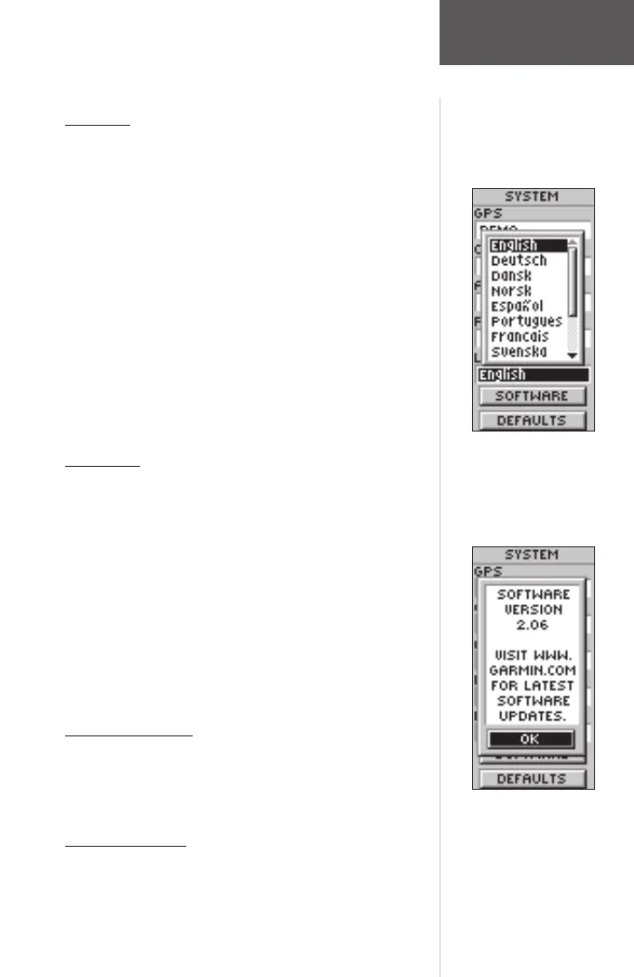
Language
The eTrex Summit can display in 12 languages.
To select a language:
1. With the MENU Page displayed, highlight ‘SETUP’
and press ENTER. The SETUP Page appears.
2. Using the UP or DOWN Button, highlight ‘SYSTEM’
and press ENTER. The SYSTEM Page appears.
3. Using the UP or DOWN Button, highlight the ‘LAN-
GUAGE’ fi eld and press ENTER.
4. Using the UP or DOWN Button, highlight the desired
selection and press ENTER.
Software Button
The Software Page shows the eTrex Summit’s current
software version. To update the eTrex Summit’s software,
visit the GARMIN web site www.garmin.com.
Defaults Button
The ‘DEFAULTS’ Button resets all of the ‘SYSTEM’
setting to the factory defaults.
System Page
The eTrex Summit can display
in 12 different languages.
190-00193-00_0D.indd 02/12/01, 10:09 AM55