Home
Garmin
Autopilot System
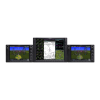
G1000 NXi
Garmin G1000 NXi Reference Guide
5
of 1
of 1 rating
260 pages
Give review
Manual
Specs
To Next Page
To Next Page
Loading...
Cockpit Reference Guide
Cessna NA
V III
System Software V
ersion 2501.09 or later
®
2
Table of Contents
Table of Contents
19
Flight Instruments
27
Enabling/Disabling or Modifying Individual Vspeed Reference Bugs
27
Enabling/Disabling Vspeed Reference Bugs as a Group or Restoring
27
All Default Settings
27
Selecting the Altitude Display Units
27
Setting the Selected Altitude
28
Enabling Altitude Units Overlays
28
Selecting the Altimeter Barometric Pressure Setting
28
Selecting Standard Barometric Pressure (29.92 in Hg)
28
Change Altimeter Barometric Pressure Setting Units
28
Setting the BARO QFE
29
Displaying the Metric Altitude Overlay
30
Setting Baro Transition Alerts
30
Change Navigation Sources
31
Enabling/Disabling the HSI Map on the PFD
31
Adjusting the Selected Heading
31
Adjusting the Selected Course
31
Changing the Navigation Angle True/Magnetic Setting
31
Selecting Bearing Display and Changing Sources
32
Changing the Selected GPS CDI Setting
32
Enable/Disable OBS Mode While Navigating with a GPS Flight Plan
32
Displaying the DME Information Window
33
Using the Generic Timer
33
Changing the Temperature Display Units
33
Displaying Wind Data
34
Setting the Baro Transition Alerts
34
Set Baro/Temp Comp Minimum Altitude Alert and Bug
35
Synthetic Vision
35
Configuring Field of View
36
Engine Indication
37
Engine Displays
37
Engine Page
50
Turbine Inlet Temperature
51
Exhaust Gas Temperature
51
Cylinder Head Temperature
51
Lean Engine Page
52
Fuel Calculations
53
Oil Pressure and Temperature Gauges
55
Fuel Quantity
55
Nav/Com/Transponder/Audio Panel
57
Enter or Change a Flight ID (Optional)
57
ADF Tuning (Optional)
57
DME Tuning (Optional)
57
Selecting Transponder Mode
57
Enter a Transponder Code
58
Selecting a COM Radio
58
Selecting a NAV Radio
58
NAV/COM Tuning
58
Auto-Tuning Radios on the PFD
59
Auto-Tuning from the MFD
59
Digital Clearance Recorder and Player
60
Intercom System (ICS) Isolation (GMA 1347)
60
Intercom System (ICS) Isolation (GMA 1360)
61
Audio (GMA 1360)
62
Blue-Select Mode (Telephone/Entertainment Distribution) (GMA 1360)
63
Bluetooth ® (GMA 1360)
63
Flight Management
65
Changing a Field in the MFD Navigation Status Box
65
Using Map Displays
65
Changing the Navigation Map Orientation
65
Enabling/Disabling Auto North up and Selecting the Minimum Switching Range
65
Configuring Automatic Zoom
66
Panning the Map
66
Reviewing Information for an Airport, NAVAID, or User Waypoint
67
Viewing Airspace Information for a Special-Use or Controlled Airspace
67
Measuring Bearing and Distance between any Two Points
67
Displaying/Removing Topographic Data on All Mfd Pages
67
Pages Displaying Navigation Maps
67
Displaying/Removing Topographic Data on the PFD Inset Map or the HSI Map
68
Displaying/Removing Topographic Data Using the
68
Map - Navigation Map' 'Page Menu' Window
68
Selecting a Topographical Data Range (Terrain Display)
68
Displaying/Removing the Topographic Scale (Topo Scale)
69
Setting up the 'Land', 'Aviation' or 'Airspace' Group Items
69
Decluttering the MFD Navigation Map
69
Decluttering the PFD Map
70
Displaying/Removing Airways
70
Selecting an Airway Range (Low ALT Airways or High ALT Airways)
70
Setting up Additional 'Map' Group Items
70
Waypoints
71
Selecting an Airport for Review by Identifier, Facility Name, or Location
71
Selecting a Runway
71
Viewing a Destination Airport
71
Viewing Information for a Nearest Airport on the PFD
72
Viewing Information for a Nearest Airport on the MFD
72
Viewing Runway Information for a Specific Airport
72
Selecting Nearest Airport Surface and Minimum Runway
73
Length Matching Criteria
73
Viewing Non-Airport Waypoints
73
Viewing Nearest Non-Airport Waypoints
73
Creating User Waypoints from the 'WPT - User WPT Information' Page
74
Creating a User Waypoint from the 'FPL - Active Flight Plan' Page
75
Creating User Waypoints from Map Pages
76
Editing a User Waypoint Comment or Location
77
Changing the User Waypoint Storage Duration Default Setting
77
Deleting a Single User Waypoint
77
Deleting All User Waypoints
77
Airspaces
78
Displaying and Removing Airspace Altitude Labels
78
Turning an Airspace Alert on or off
78
Changing the Altitude Buffer Distance Setting
78
Selecting and Viewing an Airspace Alert with Its Associated Information
79
Turning Smart Airspace on or off
79
Direct-To Navigation
79
Entering a Waypoint Identifier, Facility Name, or City as a Direct-To Destination
79
Selecting an Active Flight Plan Waypoint as a Direct-To Destination
80
Selecting a Nearest, Recent or User Waypoint as a Direct-To Destination
80
Selecting any Waypoint as a Direct-To Destination
81
Selecting a Nearby Airport as a Direct-To Destination
81
Selecting a Manual Direct-To Course
81
Reselecting the Direct Course from the Current Position
81
Selecting a Waypoint as a Direct-To Destination Using the Pointer
82
Cancelling a Direct-To
82
Flight Planning
82
Changing the Flight Plan View
82
Viewing Charts and 'FPL - Active Flight Plan' Page in Split Screen Mode
83
Page in Split Screen Mode
83
Creating an Active Flight Plan
83
Creating a Stored Flight Plan
84
Adding a Waypoint to the Active Flight Plan
85
Creating and Adding User Waypoints to the Active Flight
86
Plan Using the Map Pointer
86
Adding a Waypoint to an Existing Stored Flight Plan
86
Removing an Individual Waypoint from the Active Flight Plan
86
Removing an Individual Waypoint from a Stored Flight Plan
87
Designating a Fly-Over Waypoint
87
Adding an Airway to the Active Flight Plan
88
Adding an Airway to a Stored Flight Plan
88
Removing an Entire Airway from the Active Flight Plan
89
Removing an Entire Airway from a Stored Flight Plan
89
Collapse/Expand Airways in the Active Flight Plan
90
Activating a Flight Plan Leg
90
Entering an Along Track Offset Distance
90
Entering a VNV Altitude and Along-Track Offset for the Waypoint
91
Activating Parallel Track
91
Cancelling Parallel Track
92
Determining the Closest Point Along the Active Flight Plan
92
To a Selected Waypoint
92
Creating a User-Defined Hold at an Active Flight Plan Waypoint
92
Creating a User-Defined Hold at the Aircraft Present Position
93
Creating a User-Defined Hold at a Direct-To Waypoint
93
Exiting a User-Defined Hold Inserted into the Active Flight Plan
94
Removing a User-Defined Hold Inserted into the Active Flight Plan
94
Removing a User-Defined Hold at an Off-Route Direct-To
94
Ignoring a Flight Plan Transfer from a Wireless Connection
95
Previewing a Flight Plan Transfer from a Wireless Connection
95
Storing a Pending Flight Plan
95
Activating a Pending Flight Plan
95
Deleting a Pending Flight Plan
96
Deleting All Pending Flight Plans
96
Importing a Flight Plan from an SD Card
96
Exporting a Flight Plan to an SD Card
97
Inverting the Active Flight Plan
98
Deleting the Active Flight Plan
98
Viewing Information about a Stored Flight Plan
98
Page or the 'Flight Plan' Window
99
Activating a Stored Flight Plan on the MFD
99
Inverting and Activating a Stored Flight Plan on the MFD
99
On the MFD
100
Deleting a Stored Flight Plan
100
Deleting All Stored Flight Plans
100
Changing the Active Flight Plan Comment
101
Changing a Stored Flight Plan Comment
101
Vertical Navigation
102
Enabling and Disabling VNV Guidance
102
Altitude Constraints
103
Entering/Designating or Modifying a Waypoint Altitude Constraint to be Used for Vertical Guidance
105
Removing/Undesignating an Altitude Constraint
105
Reverting a Manually Entered Altitude Constraint Back to
105
The Navigation Database Value
105
Entering or Modifying a Baro QFE Altitude Constraint
106
Modifying the VS TGT and FPA
106
Activating a Vertical Navigation Direct-To
107
Removing a VNV Direct-To Altitude Constraint
107
Enabling the Vertical Situation Display
107
Disabling the Vertical Situation Display
107
Procedures
108
Viewing Available Procedures at an Airport
108
Loading a Departure into the Active Flight Plan Using the PROC Key
109
Loading a Departure into the Active Flight Plan from the
109
WPT - Departure Information' Page
109
Loading a Departure Procedure into a Stored Flight Plan
110
Removing a Departure Procedure from the Active Flight Plan
110
Removing a Departure from a Stored Flight Plan
110
Loading an Arrival into the Active Flight Plan Using the PROC Key
111
Loading an Arrival into the Active Flight Plan from the
111
WPT - Arrival Information' Page
111
Loading an Arrival Procedure into a Stored Flight Plan
112
Removing an Arrival from the Active Flight Plan
112
Removing an Arrival from a Stored Flight Plan
113
Approach Service Levels
114
Loading an Approach into the Active Flight Plan Using the PROC Key
114
Loading an Approach into the Active Flight Plan from the
115
NRST - Nearest Airport' Page
115
Loading an Approach Procedure into a Stored Flight Plan
116
Activating a Previously Loaded Approach
117
Activating a Previously Loaded Approach with Vectors to Final
117
Loading and Activating an Approach Using the MENU Key
117
Removing an Approach from the Active Flight Plan
118
Removing an Approach from a Stored Flight Plan
118
Activating a Missed Approach in the Active Flight Plan
119
Manually Enabling/Disabling Temperature Compensation
119
For Approach Waypoint Altitudes
119
Entering a Temperature Compensated Minimum into an Approach
119
Trip Planning
120
Selecting Automatic or Manual Page Mode
120
Selecting Flight Plan or Waypoint Mode
120
Selecting a Flight Plan and Leg for Trip Statistics
120
Selecting Waypoints for Waypoint Mode
120
Entering Manual Data for Trip Statistics Calculations
121
Raim Prediction
121
Predicting RAIM Availability at a Selected Waypoint
121
Predicting RAIM Availability at the Aircraft Present Position
122
Enabling/Disabling SBAS
123
Hazard Avoidance
125
Customizing the Hazard Displays on the 'Map - Navigation Map' Page
125
STORMSCOPE ® (Optional)
125
Data Link Weather
126
Weather Product Age
127
Displaying Data Link Weather Products
130
Connext Data Requests
133
Weather Product Overview
135
FIS-B Weather Status
143
Traffic Information Service (TIS)
144
Traffic Advisory System (TAS)
145
ADS-B Traffic
150
Terrain Avoidance (Terrain Proximity, Terrain-SVT, TAWS)
154
Automatic Flight Control System
157
Activating the Flight Director
157
Vertical Modes
158
Lateral Modes
158
Combination Modes (VNV, APR, NAV, BC, GA)
159
Level Mode with (Optional) Electronic Stablility and Protection
160
Overspeed Protection
160
Underspeed Protection
160
Suspected Autopilot Malfunction
162
Level Mode
162
Overpowering Autopilot Servos
163
Reversionary Mode
163
Additional Features
165
Terminal Procedure Charts
165
Airport Directory
167
Siriusxm Radio Entertainment
168
Satellite Telephone
170
Scheduler
180
Surfacewatch (Optional)
181
Connext Bluetooth ® Management
182
Electronic Checklists
184
Auxiliary Video (Optional)
186
Electronic Stability and Protection (Esp ) (Optional)
187
Roll Engagement
190
Pitch Engagement
190
High Airspeed Protection
191
Low Airspeed Protection
191
Abnormal Operation
193
Reversionary Mode
193
Abnormal COM Operation
193
Hazard Displays with Loss of GPS Position
193
Unusual Attitudes
194
Dead Reckoning
194
Annunciations & Alerts
197
System Annunciations
197
CO Guardian Messages
199
Relative Point Obstacle Symbols and Colors
199
Relative Wire Obstacles and Colors
199
Relative Wind Turbine Obstacles and Colors
200
Terrain-SVT and TAWS-B Potential Impact Area with Annunciations
200
Terrain-SVT Alerts
201
Terrain-SVT System Status Annunciations
202
TAWS-B Alerts
203
TAWS-B System Status Annunciations
205
TIS Failure Annunciations
206
TIS Modes and Status Annunciations
206
TIS Traffic Status Annunciations
207
TAS Traffic Modes
208
TAS Failure Annunciations
208
TAS Traffic Status Annunciations
208
ADS-B Modes
209
ADS-B Traffic Failure Annunciations
210
ADS-B Traffic Status Annunciations
210
Aux - ADS-B Status' Page Messages for ADS-B Traffic
211
GDL 69A SXM Data Link Receiver Messages
212
Surfacewatch Alerts
212
AFCS Alerts
213
Voice Alerts
214
Warning CAS Annunciations
215
Caution CAS Annunciations
215
Advisory CAS Annunciations
216
Safe CAS Annunciations
216
System Message Advisories
216
Flight Plan Import/Export Messages
234
Appendix
237
PFD Softkey Maps
237
MFD Softkeys
240
Loading Updated Databases
243
Database Deletion Feature
253
Magnetic Field Variation Database Update
254
Index
258
Other manuals for Garmin G1000 NXi
System Maintenance Manual
403 pages
Supplemental Maintenance Manual
171 pages
Pilot's Guide
538 pages
Cockpit Reference Guide
270 pages
5
Based on 1 rating
Ask a question
Give review
Questions and Answers:
Need help?
Do you have a question about the Garmin G1000 NXi and is the answer not in the manual?
Ask a question
Garmin G1000 NXi Specifications
General
Manufacturer
Garmin
Display Type
LCD
Resolution
1024 x 768 pixels (XGA)
Power Supply
28 VDC
Operating Temperature
−20°C to +55°C
Related product manuals
Garmin GHC 10
26 pages
Garmin GHC 50
18 pages
Garmin GFC 500
44 pages
Garmin GFC 600
89 pages
Garmin TR-1 Gold
38 pages
Garmin GMC 7 Series
34 pages
Garmin TR-1 GOLD 906-2000-00
38 pages
Garmin GHP 12 Autopilot System
32 pages
GHP 10 Marine Autopilot System
26 pages
GHP 20 Marine Autopilot System with SmartPump
22 pages
Garmin Reactor 40
12 pages
Garmin Reactor 40 Kicker
28 pages