Do you have a question about the Garmin GPS 38 and is the answer not in the manual?
Welcome to the GPS 38 manual, outlining its structure and purpose.
Important safety warnings regarding GPS system usage and FCC compliance.
Defines key terms and concepts used in the GPS 38 manual.
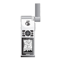
Explains the function of each button and data entry process.
Instructions on how to install and replace batteries in the GPS unit.
Explains the process and conditions for initializing the GPS receiver.
Details how the GPS 38 acquires satellite signals for positioning.
Step-by-step guide on turning the GPS unit on and initial prompts.
Describes the EZinit process for initializing the receiver with country selection.
A tour to familiarize users with basic features after initialization.
Explains the Satellite, Sky View, and Position pages and their data.
How to mark your current position as a waypoint and name it.
Demonstrates using the Position and Map pages during a walk.
Explains how to use the GOTO function to navigate to a stored waypoint.
How to interpret and use the Compass Page for steering guidance.
How to navigate between the unit's five primary pages using PAGE and QUIT.
How to clear the track log and turn off the GPS unit.
Detailed explanation of the Satellite Page and its indicators.
Explains receiver status indicators and EZinit prompt behavior.
Information on battery indicator and screen backlight settings.
Detailed explanation of the Position Page, trip odometer, and altitude display.
Step-by-step guide to marking, naming, and saving waypoints.
How to view and use the nearest waypoints list.
How to view, delete, and manage all stored waypoints.
How to create, review, and edit waypoint details.
Creating waypoints using bearing and distance from existing points.
Procedures for modifying, renaming, or deleting stored waypoints.
Details on editing waypoints and using the waypoint scanning feature.
How to activate and deactivate GOTO and Man Overboard functions.
How to use the TracBack feature to retrace your path.
Important tips for effectively using the TracBack navigation feature.
Explains route creation, legs, and navigation concepts.
Details on creating, storing, and editing routes.
Procedures for creating, copying, and clearing route data.
How to clear, activate, and invert routes for navigation.
Explains the Active Route Page and how to manage route legs.
How to edit routes and perform GOTO functions from the active route.
Explains how to select between Compass and Highway navigation pages.
Detailed explanation of the Compass Page and its features.
Detailed explanation of the Highway Page and its features.
Explanation of the Map Page, zoom, pan, and data display.
How to adjust zoom scales and pan the map display.
How to use the cursor to mark waypoints or initiate GOTO from the map.
Settings for position format, map datum, and CDI scale.
Accessing submenus and performing distance/sun calculations.
Setting operating mode, date, time, and screen contrast.
How to set time format, screen contrast, and backlight timer.
Configuring interface formats for external devices and NMEA.
Using DGPS for improved position accuracy and beacon receiver setup.
Using the simulator for practice and trip planning without satellites.
Configuring track log recording and criteria.
Explains alert messages and provides a time offset chart.
Lists available map datums and their usage.
Technical specifications and wiring information for the GPS unit.
An alphabetical index of topics covered in the manual.
| Dimensions | 2.0"W x 4.5"H x 1.25"D (5.1 x 11.4 x 3.2 cm) |
|---|---|
| Display | LCD |
| Channels | 12 |
| Waypoints | 500 |
| Routes | 20 |
| Receiver | 12-channel |
| Weight with batteries | 9.9 oz |