Do you have a question about the Garmin GPSMAP 902 series and is the answer not in the manual?
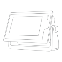
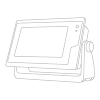
Describes chartplotter components, touchscreen gestures, on-screen buttons, and operational tips.
Guides on accessing manuals, using memory cards, locking the screen, and getting additional information.
Covers loading new software onto a memory card and updating the device software for optimal performance.
Explains how GPS signals are acquired and how to select the preferred GPS source for data.
Personalize the home screen, add favorite items, and customize pages and SmartMode layouts for quick access.
Manage presets, configure vessel type, and adjust backlight and color modes for personalized display.
Customize data overlays on screens and reset station layouts to factory defaults for a clean setup.
Explores chart views like Navigation, Perspective 3D, Mariner's Eye 3D, and features like zooming and map selection.
Details chart symbols, viewing object information, navaid details, and creating/navigating to waypoints.
Explores premium chart features, tide/current info, and the Auto Guidance system for optimal routing.
Access and view tide station and current station information, including animated indicators and data for specific dates.
View almanac data from the navigation chart and celestial information about sun, moon, and phases.
Overlay high-resolution satellite images and view aerial photos of landmarks for enhanced situational awareness.
Understand AIS targeting symbols, track vessels, and configure AIS settings for collision avoidance and traffic monitoring.
Manage MARPA targets, view information, and set safe-zone collision alarms for collision avoidance.
Learn to set and follow a direct course to a destination using the Go To function, with safety precautions.
Procedures for creating, saving, editing, and navigating routes from your current location or a specific destination.
Configure Auto Guidance settings like Preferred Depth, Vertical Clearance, and Shoreline Distance for optimal path planning.
Display active and saved tracks on charts, and learn how to save, edit, delete, and retrace tracks.
Set up boundaries to avoid or remain in designated areas, and convert routes or tracks into boundaries.
Utilize laylines, starting line guidance, and race timers to enhance performance during sailing races.
Control the autopilot for heading hold, wind hold, and tacking/gybing maneuvers for efficient sailing.
Use steering patterns like U-Turn, Circles, Zigzag, Orbit, Cloverleaf, and Search for specialized maneuvers.
Explore sonar views like Traditional, ClearVü, SideVü, Panoptix, and their underlying technologies for fishfinding.
Configure sonar settings, select sources, adjust gain, detail, color intensity, and range for optimal fishfinding.
Understand sonar frequencies, select appropriate ones, and create presets for quick adjustments based on conditions.
Change radar modes, transmit signals, and set up timed transmit or no-transmit zones for safe operation.
Adjust radar display settings like echo trails, gain, clutter, and appearance for reduced interference and clear targets.
Enable and define guard zones for alerts, use MARPA for target identification, and measure range/bearing to objects.
Scan VHF channels, adjust squelch, and use the chartplotter to make routine calls via the connected VHF radio.
Manage DSC calls, add contacts, navigate to distress signals, and handle man-overboard situations.
Display and customize engine, fuel, and wind gauges, including setting limits and selecting data sources.
Manage trip data, set fuel capacity, and visualize graphs for performance analysis.
Display weather warnings, precipitation, forecasts, fronts, and hurricane information via SiriusXM service.
Access marine, city, sea conditions, fishing forecasts, and visibility information for informed decision-making.
Control the media player, browse music, adjust volume, and set up repeat, shuffle, and zone features.
Tune into FM/AM or DAB radio stations, save presets, and scan for available channels.
Activate subscriptions, set parental controls, and customize channel guides for SiriusXM radio.
Connect and select video sources, including networked devices and cameras, for display on the chartplotter.
Configure camera settings, control pan-tilt-zoom, save video presets, and associate cameras with video sources.
Control VIRB action cameras, manage video playback, and add camera controls to other screens for convenience.
Configure system settings like Auto Power Up, sounds, display, GPS, and system information for optimal operation.
Set preferences for units, language, navigation, keyboard layout, and screenshot capture.
Configure NMEA 0183/2000 settings, name network devices, and manage marine network connections.
Set navigation, system, sonar, weather, and fuel alarms, and configure vessel details like depth and fuel capacity.
Create and connect to Wi-Fi networks, change wireless channels, and manage Wi-Fi host settings.
Pair and use a wireless remote, manage its backlight, and connect to the Garmin Helm app for device control.
Transfer waypoints, routes, tracks, and maps between the chartplotter, memory card, and computer.
Save system information to a memory card for troubleshooting and restore backup data to the chartplotter.
Troubleshoot common issues like GPS signal loss, power problems, and waypoint creation errors. Contact support.
Provides PGN information for NMEA 2000 and sentence details for NMEA 0183 communication protocols.
| Water Rating | IPX7 |
|---|---|
| NMEA 2000 Connectivity | Yes |
| Garmin Marine Network | Yes |
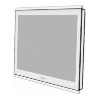
| Display Size | 9 inches |
| Mounting Options | Flush or Flat |
| Sonar Capabilities | Supports CHIRP traditional, CHIRP ClearVü, and CHIRP SideVü scanning sonars |
| Wireless Connectivity | Wi-Fi |
| SD Card Slots | microSD card slot |
| Processor | Dual-core |