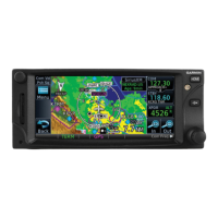
TRAFFIC Page: 9 Traffic Pop-Up Describes the traffic warning pop-up that appears on pages other than Traffic when an alert occurs.
TIS (Optional) Details the Traffic Information Service (TIS) for advisory use in locating traffic visually.
Traffic Page Configures the Traffic Map Page to show surrounding TIS traffic data relative to the aircraft's position.
TAS (Optional) Details the Traffic Advisory System (TAS) which enhances situational awareness by displaying traffic information.
ADS-B Traffic Explains ADS-B technology and its role in NextGen Air Transportation System.
ADS-B Traffic Menu Explains how to control traffic information display settings like Altitude Filter and Vector Duration.
TCAS Status Shows the current status of the TCAS system (Operate, Standby) and allows manual selection.
Altitude Filter Limits traffic displayed based on altitude modes (Below, Normal, Above, Unrestricted).
TCAD Control Menu Allows control over TCAD Traffic display settings like audio volume, field elevation, and modes.
TCAD 9900 B Operation Covers the TCAD 9900B's active system for acquiring traffic information via transponder replies.
TCAS II Explains the Traffic Alert and Collision Avoidance System II (TCAS II) for monitoring nearby airspace and resolving conflicts.
TCAS II Alerts Describes the annunciations and alerts issued by TCAS II for TA and RA events, including voice alerts.
Resolution Advisories Explains TCAS II recommended vertical guidance maneuvers (RAs) for resolving traffic conflicts.
TERRAIN Page: 10 Terrain Configurations Details available terrain awareness solutions like TAWS-A, TAWS-B, and HTAWS for situational awareness.
Terrain Proximity Introduces Terrain Proximity as a non-TSO-C151c system for terrain awareness and CFIT reduction.
Terrain Alerting Explains how terrain alerting functions increase situational awareness and reduce CFIT by providing alerts for terrain/obstacles.
Terrain Page Explains specialized display of terrain, obstacle, and threat location data for HTAWS.
Terrain Alerts Describes how alerts are issued based on parameters met by terrain alerting software algorithms.
TAWS-A (Optional) Introduces TAWS-A as an optional feature for situational awareness and CFIT reduction, satisfying TSO requirements.
TAWS-A Page Explains the specialized display of terrain, obstacle, and threat location data for TAWS-A.
TAWS-A Alerts Describes TAWS-A alerts issued when flight conditions meet algorithm parameters, including visual and aural notifications.
TAWS-A Alert Types Lists TAWS-A alert types, including FLTA, PDA, and GPWS alerting categories.
TAWS-A Alerts Summary Provides a summary of TAWS-A alerts, including annunciator text, pop-up alerts, and aural messages.
SERVICES;MUSIC Page: 13 Music Details the optional SiriusXM Radio entertainment feature, accessible via GDL 69A and controlled by GTN.
Music Operation Explains how to select music categories, channels, save presets, and manage volume levels.
Making a Phone Call Guides on initiating a phone call by selecting a number or using the keypad.
SMS Text Operation Explains sending and receiving text messages through the GSR 56 phone connection.
Position Reporting Describes the system for collecting and transmitting system variables via Iridium satellite.
Creating a Contact Guides on adding new contacts by entering name, phone number, and email address.
UTILITIES Page: 14 Vertical Calculator (VCALC) Allows creating a 3D profile guiding from present position/altitude to a target altitude at a specified location.
Flight Timers Provides count up/down timers, departure time, and total trip time recording.
RAIM Prediction Predicts GPS coverage availability for current location or specified waypoint, checking satellite geometry.
Trip Planning Allows viewing DTK, DIS, ETE, ESA, and ETA information for direct-to, point-to-point, or programmed flight plans.
Point-To-Point Mode Shows fuel calculations between two selected points, using waypoints or present position.
Flight Plan Mode Displays fuel calculations for legs of a flight plan or the cumulative flight plan.
Fuel Planning Allows manual entry of fuel flow, ground speed, and fuel on board figures for planning purposes.
Checklists Provides a method for reviewing aircraft checklists, created with Garmin Checklist Editor software.
Viewing Checklists Guides on using existing checklists in order or selecting another from the menu.
SYSTEM Page: 15 System Status Provides information about the GTN unit and attached equipment, useful for customer service contact.
GPS Status Provides a visual reference of GPS receiver functions, including satellite coverage and position accuracy.
GPS Status Page Details satellite coverage, receiver status, position accuracy, and displayed position (lat/lon, altitude).
GPS Faults Communicates various GPS fault conditions affecting accuracy, including loss of integrity, navigation, or position.
GSR 56 Status Provides information about the status of the GSR 56, including Iridium signal and registration.
Setup Allows customization of unit settings, including CDI scale, date/time, airport criteria, COM/NAV radios, and keyboard format.
CDI Scale Selection Defines the scale for the course deviation indicator, allowing manual or automatic selection.
Crossfill Explains interfacing dual units to crossfill information, including automatic and manual transfer options.
GTN-to-GTN Crossfilling Details data always crossfilled (waypoints, FPL, alerts) and system setup items dependent on crossfill setting.
Alerts Settings Controls Arrival Alerts (message within proximity) and Airspace Alerts (message and filtering).
User Fields Allows configuring data field types (Data, Function, Page) shown on the Map page.
Units Settings Enables selection of conventions for various units displayed, such as altitude, distance, and fuel.
Setup Units Sets units for values displayed in the unit operation, such as Feet/Meters or Nautical Miles.
Audio Adjusts volume for click sounds, voice callouts, and key click volume.
Connext Setup - GSR 56 Provides information about the GSR 56 and Connext Registration page for satellite services.
Operation Explains data output from GTN/Flight Stream, enabling/disabling features, and managing paired devices.