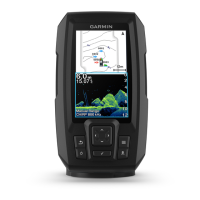
Do you have a question about the Garmin STRIKER Series and is the answer not in the manual?
Displays a full-view graph of sonar readings from a transducer.
Provides a clearer picture below the boat for detailed representation.
Shows a picture of what lies to the sides of the boat for search.
Allows viewing two frequencies simultaneously from the split frequency screen.
Displays sonar information on a circular depth scale.
Shows a magnified portion of sonar graph on left, full view on right.
Marking the current location as a waypoint directly from sonar view.
Marking a location other than the current position as a waypoint.
Adjusting sonar receiver sensitivity and reducing screen clutter.
Adjusting sonar sensitivity to reduce effects of noise from sources.
Manually setting zoom span or allowing auto-zoom based on bottom.
Adapting sonar for specific goals and present water depth.
Saving the current geographic location as a waypoint.
Creating a waypoint by entering coordinates or using the waypoint map.
Setting a Man Overboard location and navigating back to it.
Finding and following a saved waypoint's course.
Creating a route by selecting waypoints on the map.
Selecting and navigating a saved route from a list.
Compensating for temperature readings from a temperature-capable transducer.
Solutions for common issues like the device not turning on.
| Water Rating | IPX7 |
|---|---|
| Sonar Frequencies | 77/200 kHz |
| Sonar Type | CHIRP, Traditional, or ClearVü (varies by model) |
| GPS | Yes |
| Waypoints | 5, 000 |
| Battery Life | Varies by model and usage |
| Mounting | Flush Mount |
| Display Size | 3.5", 5", 7" |
| Transducer Compatibility | GT series transducers (varies by model) |