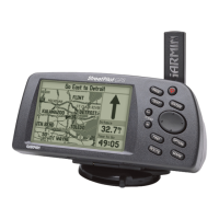
Do you have a question about the Garmin StreetPilot GPS StreetPilot GPS and is the answer not in the manual?
| Battery | Rechargeable lithium-ion |
|---|---|
| Voice Prompts | Yes |
| Touchscreen | No |
| Waterproof | No |
| Receiver | High-sensitivity |
| Preloaded Maps | Yes |
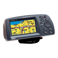
| Display | Color TFT |
| Antenna | Built-in patch antenna |
Provides an overview of the manual's sections and content.
Details critical safety information and operational precautions for the device.
Outlines the legal terms and conditions for using the device's software.
Explains regulatory compliance related to radio frequency emissions.
Specifies the terms, duration, and coverage of the product warranty.
Instructions for inserting batteries and map data cards into the device.
Explains the function of each button and navigation within the device menus.
Step-by-step guide for turning the StreetPilot device on and off.
How to optimize screen visibility in different lighting conditions.
Guidance on securely mounting the device in a vehicle and connecting power.
Process for acquiring satellite signals and determining the current GPS position.
Instructions for enabling and using the simulator for practice or planning.
Overview of the device's primary display pages and switching between them.
Methods for changing map scale and moving around the map display.
How to utilize the trip computer and access its various options.
Procedures for entering data like time zones and naming waypoints.
Steps to search for destinations and initiate navigation.
Detailed explanation of the map display, vehicle pointer, and satellite icons.
How to adjust the map's zoom level and view different scales.
Information displayed regarding direction, speed, and estimated time.
Techniques for navigating the map and selecting points of interest.
Creating, naming, and saving locations as personal waypoints.
Navigating to saved waypoints and customizing map display settings.
Configuring map detail, orientation, and auto-zoom for personalized views.
Explains the Trip Computer and Satellite Status views on the dashboard.
Detailed guide on using the trip computer for tracking travel statistics.
Understanding satellite signal status and setting the device's initial location.
Introduction to searching for various locations like cities and points of interest.
Adjusting various system settings including display, alarms, and communication.
Step-by-step instructions for finding specific addresses and street intersections.
Guidance for navigating directly to a chosen destination.
Procedures for building, editing, and managing navigation routes.
Lists available accessories and their part numbers.
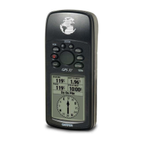
Technical details, physical dimensions, and performance metrics of the device.
Information on connecting the device to external hardware and supported interfaces.
Guidelines for keeping the device in good condition and basic troubleshooting.
Explanations for various system messages and status alerts.
Definitions of key terms used in GPS and navigation.
A reference chart for setting the correct time zone offset.
An alphabetical listing of topics for quick reference.