Do you have a question about the Garmin StreetPilot GPS and is the answer not in the manual?
Provides an overview of the manual's structure and purpose for new users.
Explains the manual's structure, sections, and purpose for user convenience.
Clarifies how important information is presented throughout the manual.
Provides critical safety advice regarding device placement and operation in vehicles.
Outlines the legal terms and conditions for using the StreetPilot software.
Details the device's adherence to Federal Communications Commission regulations.
Explains the terms and conditions of the product's warranty coverage.
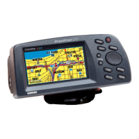
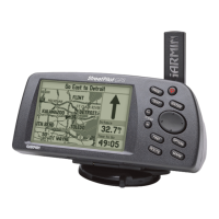
Identifies and describes the main physical components of the StreetPilot device.
Instructions for installing batteries and map data cards for device operation.
Explains the function and operation of each key on the StreetPilot keypad.
Step-by-step guide to powering the StreetPilot device on and off.
How to modify screen lighting for optimal viewing conditions.
Procedures for mounting the device and connecting to an external power source.
Initial steps to acquire GPS satellite signals and determine the device's position.
How to use the simulator mode for planning and practice indoors.
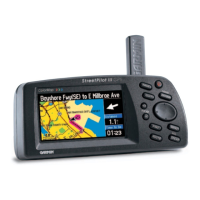
Explains the different primary display pages and how to switch between them.
Instructions on how to adjust map scale and navigate the map display.
How to access and reset the Trip Computer data using the OPTION key.
General procedures for entering data using the keypad.
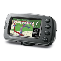
How to search for locations and initiate navigation.
Details the primary map display, including location pointer and satellite status.
How to change the map scale to view different levels of detail.
Explains the information shown on the map page regarding driving direction and status.
How to move the map view to explore areas not currently displayed.
Instructions on creating, naming, and managing saved locations.
Steps to navigate to a previously saved personal waypoint.
Customizing the display and information shown on the Map Page.
Adjusting map detail, vehicle display, and orientation settings.
Configuring approaching waypoint and speed alarms for alerts.
Setting time format, time zone, and daylight saving options.
Configuring serial data format for external device communication.
Saving the current location as a named waypoint for later recall.
Overview of the various search capabilities for locations and points of interest.
Detailed steps for locating cities by nearest or by name.
Searching for previously saved personal waypoints.
Procedures for removing saved waypoints from the device.
Locating highway exits and associated services.
Searching for points of interest like restaurants, lodging, and attractions.
Step-by-step guide to searching for specific street addresses.
How to search for and locate street intersections.
Navigating to a destination using a direct, straight-line path.
Understanding the Road Sign Page when navigating a Direct Goto.
Planning, creating, and managing custom travel routes.
Modifying previously created routes by adding or removing points.
Choosing a route for navigation or removing it from memory.
Duplicating an existing route to use as a base for a new one.
Following a planned route with turn-by-turn guidance.
Lists all standard and optional accessories available for the StreetPilot.
Technical details regarding the device's physical dimensions and performance capabilities.
Details supported NMEA and GARMIN proprietary sentences for data transfer.
Provides solutions for common operational problems and issues.
Explains the meaning and resolution of various on-screen system messages.
Defines key terms used in GPS navigation and on the StreetPilot.
Chart and instructions for setting the correct local time zone and UTC offset.
| Display Resolution | 320 x 240 pixels |
|---|---|
| Receiver | High-sensitivity GPS receiver |
| SD Card Slot | Yes |
| Voice Guidance | Yes |
| Touchscreen | Yes |
| Waterproof | No |
| Display | Color TFT |