Do you have a question about the Garmin DEZL 580LMT-S and is the answer not in the manual?
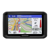
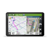
Provides an overview of the dēzl 580 device, including its keys and ports.
Instructions for mounting the device in a vehicle and connecting it to power.
Details on how to power the device on, off, or put it into power saving mode.
Explains the process of acquiring GPS signals for navigation.
Describes the icons displayed in the status bar for device information.
Explains how to use the on-screen buttons for device navigation.
Guide on how to adjust the device's audio volume.
Instructions for enabling automatic volume adjustment based on ambient noise.
Details on using the audio mixer to adjust volume levels for different audio types.
Instructions for adjusting the display's brightness level.
Steps to add a new vehicle profile for custom routing.
How to select and activate a previously created vehicle profile.
Procedure to update trailer details within an existing vehicle profile.
Instructions for modifying vehicle profile information and renaming.
Guide to enable or disable audible alerts for driver awareness features.
Information on the red light and speed camera alert feature.
Introduction to creating and using routes for navigation.
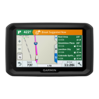
Steps to begin navigating to a destination.
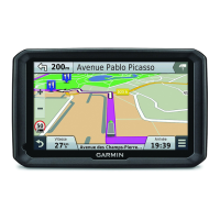
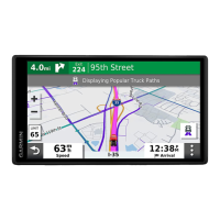
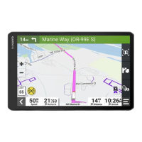
Explains how the active route is displayed on the map.
Details on the active lane guidance feature for turns.
How to view upcoming turns and directions while navigating.
Information and prompts provided when approaching the destination.
Feature to find nearby parking areas when approaching a destination.
How to modify an active route by adding or removing stops.
Instructions for manually adjusting a route's path.
Procedure to create a detour around specific roads or distances.
Settings to adjust how routes are calculated (e.g., fastest time, shortest distance).
How to end the current navigation session.
Settings to configure route preferences for avoiding specific road elements.
How to avoid specific road features like unpaved roads or ferries.
Allows users to define specific roads or areas to avoid in routing.
Instructions for using the device in Off Road mode for non-road navigation.
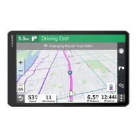
Information about browsing and searching for points of interest.
Locating trucking-specific points of interest like truck stops.
Using the search bar to find locations by category, name, or address.
How to search for locations by browsing predefined categories.
Display and interpretation of location search results.
Options to modify the area used for location searches.
Details on finding and understanding parking information.
Steps to find a specific address for navigation.
Information about the integrated Foursquare location service.
How to connect the device to a Foursquare account via Smartphone Link.
Instructions for saving favorite locations for quick access.
Locating essential services like hospitals, police stations, and fuel stations.
Procedure to remove saved locations from the device.
Overview of the map tools available for quick access during navigation.
Feature that displays upcoming points of interest and road information.
Explanation of symbols used on the map for hazards and road conditions.
Displays warnings for vehicle restrictions like height or weight limits.
Accessing and viewing trip data such as speed and distance.
How to view traffic incidents and flow along the route.
Settings to customize the appearance and data displayed on the map.
Options to select which map layers, like POIs, are displayed.
Provides information on live data services like traffic and weather.
How to send locations from a smartphone to the dēzl device.
Displays notifications from a paired smartphone on the device.
How the device receives and displays notifications from a smartphone.
Enables making and receiving phone calls using the device via Bluetooth.
Instructions for initiating a phone call using the device.
How to make calls using contacts from the phone's address book.
Steps to connect the dēzl device to the Smartphone Link app on an Apple device.
How to disable the hands-free calling feature for Apple devices.
How to disable Smartphone Link data and notifications for Apple devices.
Steps to connect the dēzl device to the Smartphone Link app on an Android device.
How to disable specific Bluetooth features for Android devices.
Procedure to enable or disable traffic data reception.
How to view traffic flow and delays displayed on the map.
Steps to find specific traffic incidents on the map.
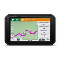
Feature to help drivers plan breaks and manage drive hours.
How to use the suggested break locations provided by the device.
How to adjust logged drive hours to match service records.
Information about the Garmin eLog adapter for ELD compliance.
Feature for sharing trip status with dispatchers or contacts.
Recording fuel data and miles for International Fuel Tax Agreement.
How to log vehicle service and maintenance records.
Procedure to add custom categories for service history entries.
How to set a custom phrase to activate voice command.
Steps to activate the voice command feature by saying the wakeup phrase.
Alternative voice interface for controlling the device.
How to access and use applications installed on the device.
Configuration for map display and vehicle icon settings.
Settings related to route calculation, avoidances, and traffic preferences.
Options to set route calculation methods like Fastest Time or Off Road.
Manage Wi-Fi networks, paired Bluetooth devices, and features.
Configure driver alerts, fatigue warnings, and proximity alerts.
Adjust screen brightness, orientation, and display timeout.
Configure traffic data reception and alert preferences.
View device information, regulatory details, and manage data reporting.
How to restore device settings to factory defaults.
Information on device care, cleaning, and support.
Instructions for updating device maps and software.
Method for updating maps and software directly via Wi-Fi.
Method for updating maps and software using Garmin Express software.
Guidelines for the physical care and maintenance of the device.
Instructions for safely cleaning the device's touchscreen.
Procedure to reset the device if it stops functioning.
Common issues and their solutions for the dēzl device.
Troubleshooting steps for a suction cup that does not adhere properly.
Guide on how to install a memory card for additional storage.
Information on storing, managing, and transferring files on the device.
Steps to connect the device to a computer for data transfer.
Information on where to purchase compatible accessories.
| Screen Size | 5 inches |
|---|---|
| Display Resolution | 480 x 272 pixels |
| Touchscreen | Yes |
| Lifetime Map Updates | Yes |
| Lifetime Traffic Updates | Yes |
| Bluetooth | Yes |
| Wi-Fi | No |
| Voice-Activated Navigation | Yes |
| Custom Truck Routing | Yes |
| Truck-Specific Points of Interest | Yes |
| Smartphone Notifications | Yes |
| TripAdvisor Ratings | Yes |
| Battery Life | Up to 1 hour |
| Display Type | TFT |
| GPS Receiver | High-sensitivity |
| Preloaded Maps | Yes |