Do you have a question about the Garmin DEZL 780 and is the answer not in the manual?
Setting up and managing vehicle profiles for accurate routing.
Information on alerts for schools, speed limits, animals, curves, and road conditions.
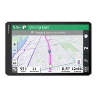
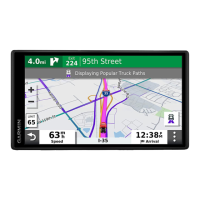
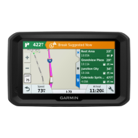
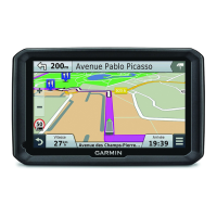
Starting routes, using maps, finding destinations, and going home.
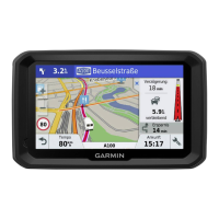
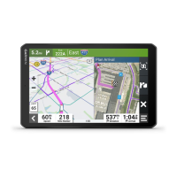
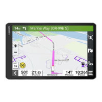
Understanding the map display, upcoming turns, and lane guidance.
Options to avoid traffic, tolls, road features, and environmental zones.
Using the map, map tools, and Up Ahead feature for navigation.
Viewing traffic flow, incidents, and customizing map layers.
Pairing phone, using live services, and sending locations.
Pairing devices, hands-free calling, and managing Bluetooth connections.
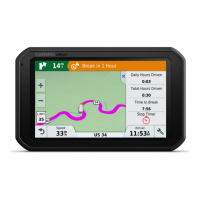
Setting up the Garmin eLog adapter and driver profiles.
Backing up, restoring data, and daily operation guidelines for eLog.
Navigating the eLog app, changing duty status, and driving in teams.
Viewing logs, submitting daily logs, and preparing for inspections.
Understanding malfunctions, driver/carrier responsibilities, and data transfer.
Explains power, engine sync, timing, and data transfer diagnostic events.
Details power, engine sync, timing, positioning, and data recording malfunctions.
Solutions for suction cup, satellite signal, charging, and battery problems.
| Form factor | Fixed |
|---|---|
| Product color | Black |
| Supported radio bands | Not supported |
| Bluetooth | Yes |
| Storage media type | Memory card |
| Compatible memory cards | MicroSD (TransFlash) |
| Widescreen | - |
| Display diagonal | 6.95 \ |
| Display resolution | 1024 x 600 pixels |
| Display size (HxV) | 152 x 89 mm |
| Display size (HxV) (imperial) | 6 x 3.5 \ |
| Input current | 2 A |
| Operating voltage | 5 V |
| Power source type | Battery |
| Battery life (max) | 2 h |
| Number of batteries supported | 1 |
| Hands-free calling | Keep your hands on wheel with Bluetooth™ Hands-free calling. After pairing your compatible Bluetooth mobile phone to your TomTom GPS, you’ll be able to see incoming call information, make and answer calls, and talk hands-free through your device. You’ll e |
| Traffic Message Channel (TMC) | No |
| Headphone connectivity | 3.5 mm |
| Cables included | USB |
| Operating temperature (T-T) | -10 - 55 °C |
| Lifetime map updates | Roads change, but with Lifetime Map Updates your map will always be up to date. Start fresh every few months by downloading a new edition of the industry's most accurate map. New editions are issued four times per year. |
| Depth | 122 mm |
|---|---|
| Width | 199 mm |
| Height | 24 mm |
| Weight | 437 g |