Do you have a question about the Garmin DEZL OTR810 and is the answer not in the manual?
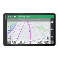
Provides a visual guide to the device's main components and features, including ports and controls.
Instructions for securely mounting the device in your vehicle and connecting it to power.
Steps to turn the device on, off, or enter power saving mode.
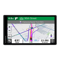
Overview of the device's main interface, shortcuts, and app drawer.
Steps to create and configure a profile for different vehicle types, including lorries.
How to manually select or switch the active vehicle profile on the device.
Instructions for modifying, renaming, or deleting vehicle profiles.
How to configure audible alerts for various driving conditions and safety warnings.
Information on device alerts for traffic enforcement cameras and database updates.
Overview of methods to find destinations using the 'Where To?' menu.
How to locate specific services and facilities catering to lorries.
Methods for finding lorry parking and parking near the current destination.
Locating nearby hospitals, police stations, and fuel stations.
Methods for saving destinations, including the current location.
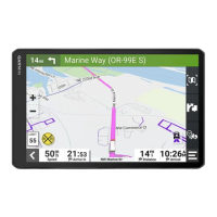
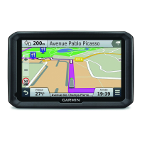
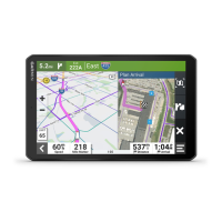
Initiating navigation to a selected destination via recommended or alternative routes.
How to set and navigate to your home destination efficiently.
Visual cues for selecting the correct lane during turns and interchanges.
Preparing for arrival at lorry destinations like parking or loading docks.
Finding parking spots recommended by the device near your destination.
Adding, reordering, or removing destinations in an active route.
Manually adjusting the route's path to include specific roads or areas.
Creating detours for distance or specific roads due to road conditions.
Configuring the device to avoid traffic delays, road features, and environmental zones.
Setting up custom preferences to avoid specific roads or areas on routes.
Viewing upcoming locations like services, restaurants, and fuel stations.
Viewing, customizing, and resetting trip data and history.
Checking upcoming traffic incidents and viewing traffic flow on the map.
Steps to connect your dēzl device to a smartphone via the dēzl app.
Using the device for making and receiving phone calls via Bluetooth.
Receiving traffic data via smartphone and viewing traffic on the map.
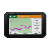
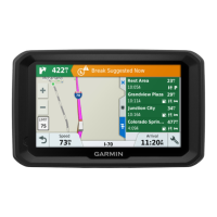
Utilizing the break planner for rest stop reminders and suggestions.
Recording fuel purchase data and miles driven for IFTA documentation.
Recording fuel purchase details, type, and price.
Instructions for installing and configuring the Garmin eLog adapter.
Moving recorded eLog data from another device to your dēzl unit.
Procedures for backing up and restoring recorded hours of service data.
Overview of the eLog app interface, driver status, and key functions.
Updating your duty status (e.g., Driving, Off Duty) in the eLog app.
Making corrections or updates to historical duty status entries.
Reviewing, accepting, or declining logs and certifying daily records.
Creating and saving Record of Duty Status reports outside the app.
Submitting RODS reports via web services or email to inspectors.
Understanding indicators for diagnostic events and malfunctions.
Creating new driver profiles and configuring their settings.
Modifying driver privileges, resetting passwords, or deactivating profiles.
Using voice commands to search locations and start routes.
Creating, saving, and editing routes for deliveries or trips.
Using the app to turn connected accessories on or off.
Setting up routines to automatically control switches based on triggers.
Configuring route calculation, avoidances, and voice language.
Configuring alerts for driver awareness features and proximity warnings.
Enabling traffic features, setting providers, and optimizing routes.
Downloading and installing updates wirelessly without a computer.
Using Garmin Express software to update device maps and software.
Wiring guidelines and requirements for connecting accessories to the device.
Wiring the device to the vehicle's battery for operation.
Connecting and setting up a BC™ 50 backup camera.
| Display Size | 8 inches |
|---|---|
| Display Resolution | 1280 x 800 pixels |
| Maps | Preloaded street maps |
| Bluetooth | Yes |
| Wi-Fi | Yes |
| Truck Specific Routing | Yes |
| Voice Control | Yes |
| Touchscreen | Yes |
| Lifetime Map Updates | Yes |
| Voice Activation | Yes |
| Built-in Camera | No |