Do you have a question about the Garmin DEZL OTR610 and is the answer not in the manual?
Provides an overview of the d uevozl device, its ports, and key features.
Instructions for safely mounting the device and connecting it to power.
Covers turning the device on/off, acquiring GPS, status icons, and on-screen buttons.
Details on adjusting volume, using the audio mixer, and screen brightness.
How to add a new vehicle profile with its dimensions and characteristics.
Covers switching, changing trailer info, and editing existing vehicle profiles.
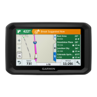
Explains driver alerts, warnings, and red light/speed camera notifications.
Details specific alerts for speed limits and traffic cameras.
Guides on finding locations via search bar and addresses.
How to find various POIs, including truck services, categories, and Tripadvisor.
Finding parking, viewing location history, and clearing recent searches.
Steps to save, edit, and categorize favorite locations.
How to start routes, choose destinations, and plan routes.
Using the map to navigate, find home, and edit home location.
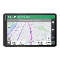
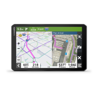
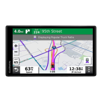
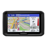
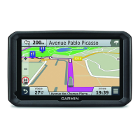
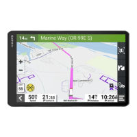
Understanding the route display on the map, including next actions and distance.
Features for planning arrival, viewing lorry paths, and completing routes.
Adding shaping points and taking detours to customize route calculation.
Settings for route calculation mode, avoidances, and custom avoidances.
Using map tools like Up Ahead, Towns Ahead, and viewing data.
Adjusting map layers, data fields, and perspective.
How to receive traffic data via smartphone or traffic receiver.
Displaying traffic flow and searching for incidents on the map.
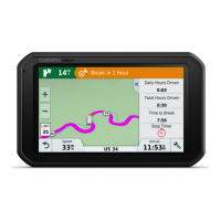
Features for planning breaks, timers, and adjusting drive hours.
Setting up and using the Garmin eLog for hours of service and fuel tracking.
Logging vehicle service history, adding categories, and editing records.
Tips for speaking to the device and launching voice-activated navigation.
Using voice for calls, changing settings, and accessing apps.
Viewing weather forecasts, radar, alerts, and road conditions.
Creating, editing, and saving routes, including reordering and shaping.
Viewing and saving live traffic camera images.
Controlling music playback from the paired smartphone.
Customizing buttons, assigning switches, and adding custom layouts.
Setting up routines to automate device functions based on triggers.
Configuring map display, vehicle icons, and map layers.
Adjusting calculation mode, avoidances, and GPS simulator.
Managing Wi-Fi, Bluetooth, and driver assistance alerts.
Adjusting display, units, time, language, and privacy options.
Technical specifications, operating ranges, and power input.
Methods for charging the device's battery.
How to update maps and software via Wi-Fi or Garmin Express.
Cleaning, avoiding theft, restarting, and troubleshooting common issues.
Detailed steps for installing the Garmin PowerSwitch device and accessories.
Installing memory cards, connecting to computers, and transferring data.
| Display Type | Touchscreen |
|---|---|
| Resolution | 1024 x 600 pixels |
| Bluetooth | Yes |
| Voice Command/Voice-activated navigation | Yes |
| Truck Specific Routing | Yes |
| Wi-Fi | Yes |
| Lifetime map updates | Yes |
| USB | Yes |
| MicroSD card slot | Yes |
| Display Size | 6 inches |
| Maps | Preloaded North America maps |
| Weight | 1.3 lbs |