R
Richard MckenzieJul 26, 2025
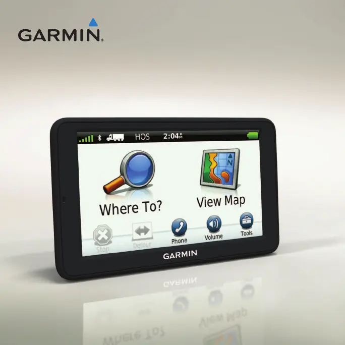
What to do if my Garmin dezl 560 is not acquiring satellite signals?
- NNatalie HoffmanJul 26, 2025
First, ensure that the GPS simulator is turned off by going to Tools > Settings > System > GPS Simulator > Off from the main menu. Then, move your Garmin GPS out of parking garages and away from tall buildings and trees. Remain stationary for several minutes to allow it to acquire signals.