Do you have a question about the Garmin dezl 570 Series and is the answer not in the manual?
Connect the device to the vehicle's power source using the provided cable for charging and operation.
Ensure satellite signal strength for navigation by turning on the device outdoors away from obstructions.
Create a profile for your truck, including dimensions and weight, for accurate routing.
Select and activate a previously created vehicle profile to tailor navigation settings.
Modify existing vehicle profile details, rename, or delete profiles.
Understand how routes are calculated based on preferences and vehicle profiles.
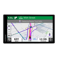
Initiate navigation to a destination by searching and selecting a location.
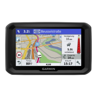
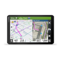
View visual simulations to help select the correct lane for upcoming turns.
Insert intermediate stops or destinations into an active navigation route.
Manually adjust the route path to favor specific roads or areas without adding a stop.
Reroute around specific road segments or for a specified distance.
Select calculation preferences like faster time, shorter distance, or less fuel.
Create and save multi-stop routes for future navigation, like deliveries or vacations.
Automatically reorder trip stops for a more efficient and shorter route.
Modify, add, or remove stops within a saved trip.
Configure route preferences to avoid specific road elements like tolls or restricted areas.
Search for locations by entering categories, addresses, cities, or coordinates.
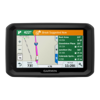
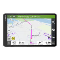
Locate truck stops, rest areas, weigh stations, and other truck-specific services.
Access the TruckDown directory for truck repair and tire sales services.
Search for locations by entering street address details.
Search for locations by city name or by selecting nearby cities.
Access details about your current position for emergency services.
Locate nearby hospitals, police stations, and fuel stations.
Store specific locations on the device for later access.
Designate a primary location, often home, for quick access.
Update information, categories, or map symbols for saved locations.
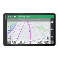
See traffic incidents and flow along your route.
Display color-coded traffic flow and delays on nearby roads.
Display truck-specific routes, TruckDown directory, and other trucking information.
How to receive traffic data via a physical traffic receiver accessory.
How to receive live traffic data via a connected smartphone.
Archive data for International Fuel Tax Agreement documentation.
Record fuel purchases, price, and quantity for IFTA logging.
Access and export state or province operating data for IFTA reporting.
Manage, edit, and export trip reports for IFTA compliance.
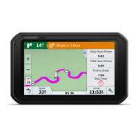
Record duty status for compliance with Federal Motor Carrier Safety Administration regulations.
Log off duty, sleeper, driving, or on-duty status.
View and manage driving log data, including status details and violations.
Save driving logs to a computer for record-keeping.
Record vehicle service and maintenance details, including odometer readings.
Connect your compatible phone to the device via Bluetooth for hands-free operation.
Connect to a smartphone for live data, navigation syncing, and enhanced features.
Install the Smartphone Link application on your compatible smartphone.
Pair the device with the Smartphone Link app via Bluetooth.
Access real-time data like traffic conditions and weather forecasts.
Features for improving fuel economy and tracking fuel costs.
Improve fuel economy accuracy by calibrating the device with fuel fill-up data.
Configure route calculation, avoidances, and restrictions.
Define how routes are calculated (e.g., faster time, shorter distance, less fuel, off-road).
Configure Bluetooth connection, search for devices, and set a friendly name.
Enable traffic data, set the provider, and configure traffic alert preferences.
Reset device settings to factory default values.
Force a restart of the device by holding the power key if it becomes unresponsive.
Access services like product manuals, software updates, and map updates.
Install and configure Garmin Express for managing device software and maps.
Use Garmin Express software to download and install the latest map and software updates.
Copy files between your computer and the device using a USB connection.
Troubleshoot issues with the device failing to acquire GPS signals.
Solve problems related to the device not charging when connected to a vehicle power outlet.
Address issues causing the device battery to drain quickly.
Troubleshoot device recognition issues on Windows computers.
Troubleshoot device recognition issues on Mac computers.
Troubleshoot Bluetooth connection issues between the phone and the device.
| Display Type | WQVGA color TFT with white backlight |
|---|---|
| Display Resolution | 480 x 272 pixels |
| Battery | Rechargeable lithium-ion |
| Dimensions | 5.5"W x 3.4"H x 0.8"D (13.9 x 8.6 x 2.0 cm) |
| Bluetooth | Yes |
| Voice Command | Yes |
| Accepts Data Cards | microSD card (not included) |
| Custom POIs | Yes |
| Truck-specific routing | Yes |
| Bluetooth calling | Yes |
| Wi-Fi | No |
| Truck-specific points of interest | Yes |
| Display Size | 5 inches |
| Lane assist | Yes |