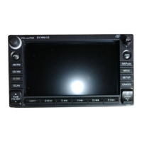
Honda Compact Navigation System Owner’s Manual 7
Getting Started
Finding Points of Interest in
Pedestrian Mode
While in pedestrian mode in certain
cities, you may use cityXplorer
™
maps to navigate using public transit.
Go to www.garmin.com for more
information on cityXplorer maps.
1. Select Pedestrian transportation
mode (page 5).
2. From the main menu, touch
Where To? > Points of Interest.
3. Select a category.
4. If necessary, select a subcategory.
5. Select a destination.
6. Select an option:
Touch • Walk to calculate a
route you will navigate by
walking.
Touch • Public Transit to
calculate a route that uses
public transit and walking.
7. Touch Go!.
Adding Points to the
Active Route
1. While navigating a route, touch
to return to the main menu.
2. From the main menu, touch
Where To?.
3. Select a category.
4. If necessary, select a subcategory.
5. Select a destination.
6. Touch Go!.
7. Touch Add to Current Route.