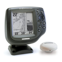
Do you have a question about the Humminbird Matrix 67 and is the answer not in the manual?
Explains the 200/83 kHz sonar system with 60° coverage, suitable for various water conditions.
Details the QuadraBeam™ sonar with 90° side coverage using 455 kHz beams for enhanced side structure detection.
Describes the WideSide transducer with three elements for left, right, and down-looking sonar.
Lists GPS features: viewing position, track, speed, and saving waypoints/routes.
Explains the MMC slot for inserting optional-purchase cards with detailed maps.
Covers depth, speed, temperature, bottom types, cursor details, and basic sonar returns.
Identifies structure, explains fish symbols and size, and defines thermoclines.
Explains the RTS® Window for real-time sonar data visualization.
Lists available Sonar views (Sonar, Zoom, Split, Big Digits, Side Beam, WideSide) and Navigation views (Bird's Eye, Chart, Combo).
Explains depth, temperature, speed readouts, depth scales, and Freeze Frame functionality.
Explains the RTS® Window's display of sonar intensity via grayscale or bar graph.
Describes charting depth changes for bottom contour and methods like Inverse, WhiteLine®, Structure ID®.
Details Inverse, Structure ID®, WhiteLine®, and Bottom Black display methods for clarity.
Explains how zoom increases resolution and the function of the Zoom Preview Box.
Displays 83 kHz wide beam and 200 kHz narrow beam returns side-by-side for comparison.
Provides depth, temperature, speed, and Triplog data in a large, easy-to-see format.
Shows sonar info from left/right 455 kHz beams and 200 kHz down-looking beam.
Displays 455 kHz SideView transducer data with Left, Both, or Right views.
Shows a 3D perspective view of track and land contour from above and behind the boat.
Displays built-in or MMC cartography with track, waypoints, and routes overlaid.
Displays Chart View on the left and Sonar View on the right side of the screen.
Selects display orientation (North-Up or Course-Up) for Chart and Combo Views.
Covers chart navigation using cursor keys, zoom keys, and the INFO key for object details.
Explains waypoints, routes for trip planning, and tracks as path history.
Describes saving current, cursor, or sonar history positions as waypoints.
Covers editing waypoint names, positions, icons, and sorting options.
Explains navigating to cursor position or specified waypoint using the GOTO key.
Covers skipping waypoints and canceling navigation during a route.
Describes adding waypoint targets with concentric circles and trolling grids for guidance.
Covers saving, creating, editing, deleting, and traveling routes.
Explains saving and clearing the active track.
Covers managing saved tracks by editing names, deleting, or changing visibility.
Explains the functions of the POWER/LIGHT, VIEW, and INFO keys for system control and information access.
Details accessing menus, using cursor control for navigation, and marking waypoints.
Explains how GOTO initiates navigation, ZOOM adjusts scale, and EXIT controls alarms and menus.
Describes the Accessory Bus for connecting peripherals and powering on the unit.
Explains the Start-Up Options, X-Press™, and Main Menu systems for system configuration.
Compares Normal and Advanced modes for menu simplicity and control.
Explains immediate view updates after menu setting changes.
Lists options like Normal, Simulator, System Status, and PC Connect.
Describes on-water use in Normal mode and using the Simulator for learning.
Reviews results of self-tests and lists connected accessories.
Displays GPS satellite sky chart and signal strength for diagnostic purposes.
Reports position, fix type, HDOP, error, altitude, speed, and heading.
Connects to PC via cable for software updates and new features.
Provides quick access to sonar settings like Sensitivity, Range, and Chart Speed.
Sets the WideSide View to Left, Both, or Right beam display.
Controls display detail by adjusting sensitivity to show more or fewer sonar returns.
Sets the shallowest depth range to be displayed on specific sonar views.
Sets the deepest depth range to be displayed, with Auto or Manual modes.
Sets the deepest range for WideSide View to keep bottom visible.
Determines how fast sonar information moves across the display.
Chooses how bottom and structure are represented (Inverse, WhiteLine®, Structure ID®, Bottom Black).
Sets the magnification level for the Sonar Zoom View.
Covers saving/clearing tracks, saving/skipping/canceling routes, and removing targets/grids.
Manages current routes by saving, skipping waypoints, or canceling navigation.
Removes waypoint targets and grids from the display.
Sets the size of the Sonar Window in the Combo View.
Lists sonar settings including Beam Select, Fish ID, Sensitivity, Depth Lines, and Surface Clutter.
Selects which sonar returns (200 kHz, 83 kHz, or both) are displayed.
Interprets sonar returns to display fish symbols and size indicators, requires Fish ID+™ to be On.
Modifies the threshold for Fish ID+™ detection for different fish sizes.
Sets the RTS® Window to Wide, Narrow, or Off for real-time sonar display.
Adjusts the sensitivity of the 455 kHz beam for QuadraBeam™ transducer.
Adjusts the sensitivity of the WideSide beam for the WideSide transducer.
Divides the display into four equal sections with horizontal depth lines.
Adjusts the filter to remove surface clutter noise caused by algae and aeration.
Limits interference from boat engine, turbulence, or other sonar devices.
Adjusts maximum depth of operation for performance tuning.
Configures the unit for fresh or salt water for accurate depth readings.
Allows selection of DualBeam, QuadraBeam™, or WideSide transducers.
Lists navigation settings including Tracks, Waypoints, Routes, View Orientation, and Map Borders.
Allows viewing the Tracks submenu for editing, deleting, or changing visibility of saved tracks.
Allows viewing the Waypoints submenu for creating, editing, deleting, or targeting waypoints.
Allows viewing the Routes submenu for creating, editing, deleting, or traveling routes.
Selects display orientation (North-Up or Course-Up) for Chart and Combo Views.
Selects how much chart detail is displayed (Basic, Navigation, Underwater, All).
Allows display or hiding of map borders, which indicate different map areas.
Covers Lat/Lon Grid, North Reference, Grid Rotation, and Spot Soundings.
Selects the time period between trackpoints to manage track detail.
Sets a minimum travel distance before a trackpoint is added to the track.
Changes the map coordinate system to match paper maps.
Sets the boat's position for use in the Simulator.
Clears the currently active map offset.
Allows deletion of all saved Tracks, Waypoints, and Routes.
Lists alarm settings including Depth, Fish ID, Low Battery, Off Course, Arrival, Drift, and Alarm Tone.
Sounds alarm when depth is equal to or less than the set value.
Sounds alarm when detected fish match the alarm setting.
Sounds alarm when input battery voltage drops to or below the set level.
Sounds alarm when the boat moves too far off the intended course.
Manages arrival proximity alerts and drift detection.
Selects the pitch of the alarm sound.
Lists settings for units, user mode, language, triplog reset, and restore defaults.
Selects units of measure for depth, temperature, and distance.
Chooses between Normal (simpler) and Advanced (more control) menu systems.
Selects the display language for menus (International models only).
Resets the Triplog to zero, clearing elapsed time, distance, and average speed.
Resets all menu settings to their factory defaults with caution.
Sets available views to hidden or visible in the view rotation.
Sets individual digital readouts for the Sonar View data windows.
Covers adjusting depth offset and temperature offset for accurate readings.
Calibrates the speed readout by a percentage, requires Temp/Speed accessory.
Configures the local time zone and adjusts for daylight savings time.
Selects the format for latitude and longitude position display.
Configures time (12/24 hour) and date (mm/dd/yy) display formats.
Turns NMEA output on or off for data sentences like DPT, GGA, RMC.
Deactivates Sonar and removes Sonar Views from the view rotation.
Explains how to connect accessories like WeatherSense and SmartCast WSL.
Addresses problems with the system not powering up or defaulting to Simulator mode.
Solves problems like control head power loss at high speeds or bottom display gaps.
Addresses issues with no fish detected or weak/faulty sonar readings.
Identifies potential sources of electrical noise and interference affecting sonar reception.
Details accessories like WeatherSense, GPS Cable, Wireless Sonar Link, and PC Connect Cable.
Lists depth capability, power output, frequency, target separation, LCD resolution, and transducer details.
Provides contact details via telephone and email, and mailing address for support.
| Brand | Humminbird |
|---|---|
| Model | Matrix 67 |
| Category | GPS |
| Language | English |