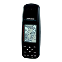
Do you have a question about the Lowrance GlobalMap 2000 and is the answer not in the manual?
Describes how to install the unit using a bracket mount, ensuring clearance behind the unit.
Provides instructions for flush-mounting the unit in a dash, including dash cutout dimensions.
Explains how to connect the unit to a 12-volt battery system, emphasizing fuse use.
Details connecting external navigation receivers and sonar modules via NMEA or other interfaces.
Explains how to connect a DGPS beacon receiver for higher accuracy positions.
Describes the SAM module for sonar data input and operation.
Configuration settings for DGPS receivers and communication protocols.
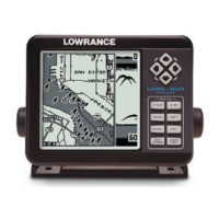
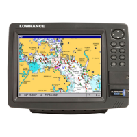
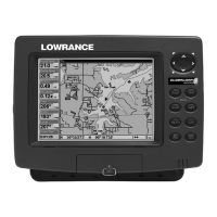
Detailed explanation of the map screen, zoom, center, and data options.
Displays navigation data numerically, including position and speed.
Shows boat direction, course, and deviation indicator for steering.
Guides on personalizing the digital displays on various unit screens.
Instructions on saving current or cursor positions as waypoints.
Method to save waypoints with more options, including selecting numbers.
Steps to change a waypoint's name, symbol, or location.
How to set a course and receive navigation data to a selected waypoint.
Steps to create a new route by naming and adding waypoints.
Methods to add waypoints to a route from map, table, or keyboard.
How to activate and navigate along a created route, forward or reverse.
Records current position for MOB situations and navigates back to it.
Resets all unit settings to original factory defaults.
Overview of the sonar module's functions and operation.
Magnifies parts of the sonar display for detailed analysis.
Identifies and displays fish symbols, with optional depth tracking.
Sets alarms for fish, zone, and depth detection.
Reduces noise and surface clutter for a clearer sonar display.
Resets all sonar settings to their factory default values.
Details the terms and conditions of the product's one-year limited warranty.
Outlines the process for sending the unit for repair or service via UPS.
Information on contacting Lowrance for service and repair in the USA.