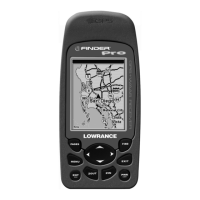
Do you have a question about the Lowrance iFINDER H2O and is the answer not in the manual?
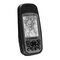
| Waterproof Rating | IPX7 |
|---|---|
| Map Support | Yes |
| Waypoints | 1000 |
| Routes | 100 |
| Channels | 12 |
| Display Type | LCD |
Explains GPS and WAAS satellite navigation principles and unit operation.
Details typographical conventions for commands, keys, and menu sequences.
Covers unit power sources, battery types, and installation procedures.
Instructions for inserting and removing MMC/SD memory cards for data storage.
Information on optional accessories like FreedomMaps, antennas, and mounting solutions.
Explains the keypad, basic controls, and the three main page displays.
A concise step-by-step guide for common Easy Mode operations.
Covers finding current position, map navigation, selecting items, and searching.
Instructions for setting waypoints (Home, MOB) and managing trails.
Covers transferring data files and switching between Easy and Advanced modes.
Overview of the keypad, menus, and page displays in Advanced Mode.
Detailed instructions for navigating, planning routes, and managing trails.
Explains map display options, data layers, and page customization.
Covers system settings like alarms, satellite search, communication ports, and coordinate systems.
Details trail options, units of measure, language, and software information.
Details alarm settings, auto satellite search, and communication port setup.
Covers coordinate system selection, map fix configuration, and map overlays.
Covers screen adjustments, language, and local time settings.
Guide to searching for addresses and highway exits.
Covers searching for POIs, streets, and intersections.
Instructions for searching and navigating to waypoints in Advanced Mode.
Lists various geodetic datums supported by the unit.
Details FCC compliance, how to obtain service, and warranty information.
Information on ordering Lowrance GPS accessories and shipping instructions.