Do you have a question about the Magellan RoadMate 3045-LM and is the answer not in the manual?
| Auto | Yes |
|---|---|
| Marine (chartplotters, sounders) | No |
| Address input | City, Street |
| Languages support | English |
| Spoken street names | Keep your eyes on the road while your GPS announces turn-by-turn directions, including street and place names. |
| USB 2.0 ports quantity | 1 |
| GPS accuracy - position | 5 m |
| Processor frequency | 400 MHz |
| Text-to-speech message reader | - |
| Map coverage | Canada, Puerto Rico, USA |
| Lifetime map updates | Roads change, but with Lifetime Map Updates your map will always be up to date. Start fresh every few months by downloading a new edition of the industry's most accurate map. New editions are issued four times per year. |
| Display diagonal | 4.7 \ |
| Display resolution | - pixels |
| Placement supported | Vertical |
| Power source type | Battery |
| Battery life (max) | 2 h |
| Operating temperature (T-T) | -10 - 70 °C |
| Storage media type | Flash |
| Compatible memory cards | MicroSD (TransFlash), SD |
| Form factor | Fixed |
| Product color | Black, Silver |
| Depth | 16 mm |
|---|---|
| Width | 136 mm |
| Height | 86 mm |
| Weight | 164.43 g |
Learn to turn the Magellan RoadMate receiver on and off using the power switch.
Monitor the device's battery charge and satellite signal strength for optimal performance.
Adjust audio output levels, including muting and button sound settings.
Customize display brightness and enable battery-saving dimming features.
Understand how to access and navigate the device's primary menu options.
Learn to use the on-screen keypad for data entry and address input.
Utilize intelligent city search for faster and more accurate destination input.
Employ predictive text for efficient and error-free street and city name entry.
Tips for choosing the optimal, safe, and legal placement for your device.
Steps for connecting the power cable to the car cradle and securing the mount.
Proper method for attaching the Magellan RoadMate unit to its car cradle.
Position the device for the best viewing angle while driving.
Connect the device to power and operate the power switch.
Secure the device against theft and understand its tracking limitations.
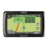
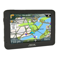
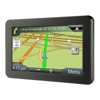
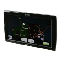
Understand normal and routing map displays and their basic elements.
Learn to access map modes, adjust zoom, pan, and set routes.
View your precise position, address, and nearby intersections.
Store your current position to the Address Book or OneTouch menu.
View route instructions and exclude specific street segments.
Adjust audio levels directly from the main navigation map interface.
Step-by-step guide to entering city, street, and number for navigation.
Navigate by specifying two intersecting streets for your destination.
Set a city's geographical center as your destination.
Quickly navigate to past locations and manage the history list.
Access, manage, and route to saved addresses and contacts.
Add new addresses manually or from Points of Interest.
Assign and update favorite locations or POI searches for quick access.
Initiate navigation to saved addresses or POI searches using OneTouch buttons.
Find and navigate to Points of Interest categorized by type (e.g., restaurants, gas).
Access and navigate to AAA-rated Points of Interest.
Search for and navigate to specific Points of Interest by their name.
Find services like gas stations or restaurants near highway exits.
Set and update your primary home address for quick navigation.
Initiate navigation to your saved home address.
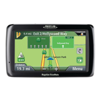
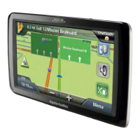
Understand the display elements when actively navigating a route.
View route instructions and select calculation methods (e.g., Fastest Time).
Set a default routing preference for all future navigation.
Learn about canceling routes, detouring, and SmartDetour™ features.
Add multiple stops to an existing route using the Go To function.
Modify the order or content of stops in a multi-destination trip.
Store complex routes to your Address Book for later use.
Understand traffic terms and visual indicators for delays.
Learn how traffic delays are displayed and how to find alternative routes.
Access merchant coupons and offers related to POI searches.
Navigate to the main settings menu for device configuration.
Customize device language, auto-power duration, and time/zone.
Adjust screen brightness and select preferred units of measure.
Configure automatic day/night map colors and 2D map orientation.
Customize POI display and enable automatic zoom for turns.
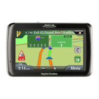
Get visual guidance for highway interchanges and lane selection.
Adjust audio volume, mute sound, and manage button feedback.
Enable or disable audible feedback for button presses.
Choose the primary method for calculating routes (e.g., Fastest Time).
Customize turn alert sounds and enable U-turn guidance.
Configure the device to bypass toll roads.
Select between QWERTY and ABC keyboard layouts for data entry.
Activate new functionalities using authorization codes.
Enable real-time traffic information and configure alerts.
Configure audible alerts for traffic warnings.
Manually set the GPS position for faster satellite acquisition.
Check the satellite signal strength and GPS receiver status.
Reset all device configurations to their original factory defaults.
Save and restore user data and settings to/from a micro SD card.
Access details like serial number and software version.