Map
13
Map
Map
Access the Map at any time by pressing the Map button.
The Map button
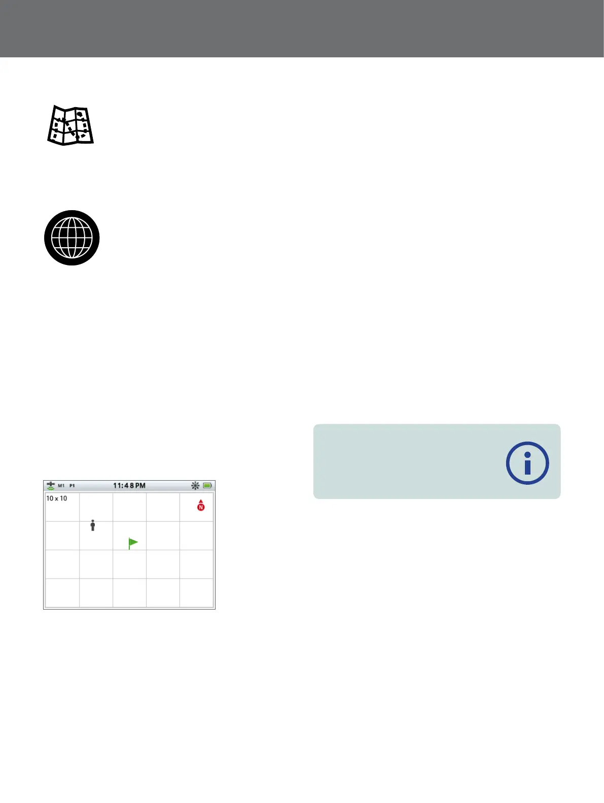
The Map displays FindPoints, WayPoints, GeoHunts
and GeoTrails in their relative geographic locations. It
represents a default map dimension of 100 yards (or
metres) in the east-west horizontal direction and 80 yards
(or metres) in the north-south vertical direction.
The map displays north-south and east-west grid lines,
centred on your current location. The distance between
the grid lines will depend on your current zoom level
(page 14). The upper horizontal edge of the screen
display will represent north irrespective of the detector
orientation.
At the top of the Map is the Status Bar, which displays
information about the current detector settings
(page 10).
Example Map screen
Use the Map to:
• View your current location and GPS coordinates
• View your GeoTrail, WayPoints, FindPoints and GeoHunts
• Navigate to a location
• View the status of the detector
For further information on the Map, see page 13.
GPS
The Global Positioning System (GPS) is a space-based
satellite navigation system that provides location and
time information from any location where there is an
unobstructed line of sight to four or more GPS satellites.
The location and navigational elements of the Map work
in conjunction with the Global Positioning System (GPS).
By default the GPS receiver is turned off and must be
turned on through the Setting page (page 21). Once
GPS is turned on a flashing GPS icon will appear on
the Status Bar. When an absolute position fix has been
established (which may take several minutes), the GPS
icon on the Status Bar will stop flashing and remain static.
On entering the Map a marker will be displayed at the
centre of the screen to represent your initial start location.
If there is a valid GPS position fix, movement will be
displayed on the Map as a series of dots that form a
GeoTrail.
On the GPZ 7000, GPS provides the capability to store
location data relating to FindPoints and WayPoints, and to
record GeoHunts. By default GPS is turned off and must
be turned on through via Settings page (page 21).
Note
If there is no WayPoint, FindPoint or GeoHunt
near the current location, the Map may be
blank.
 Loading...