19
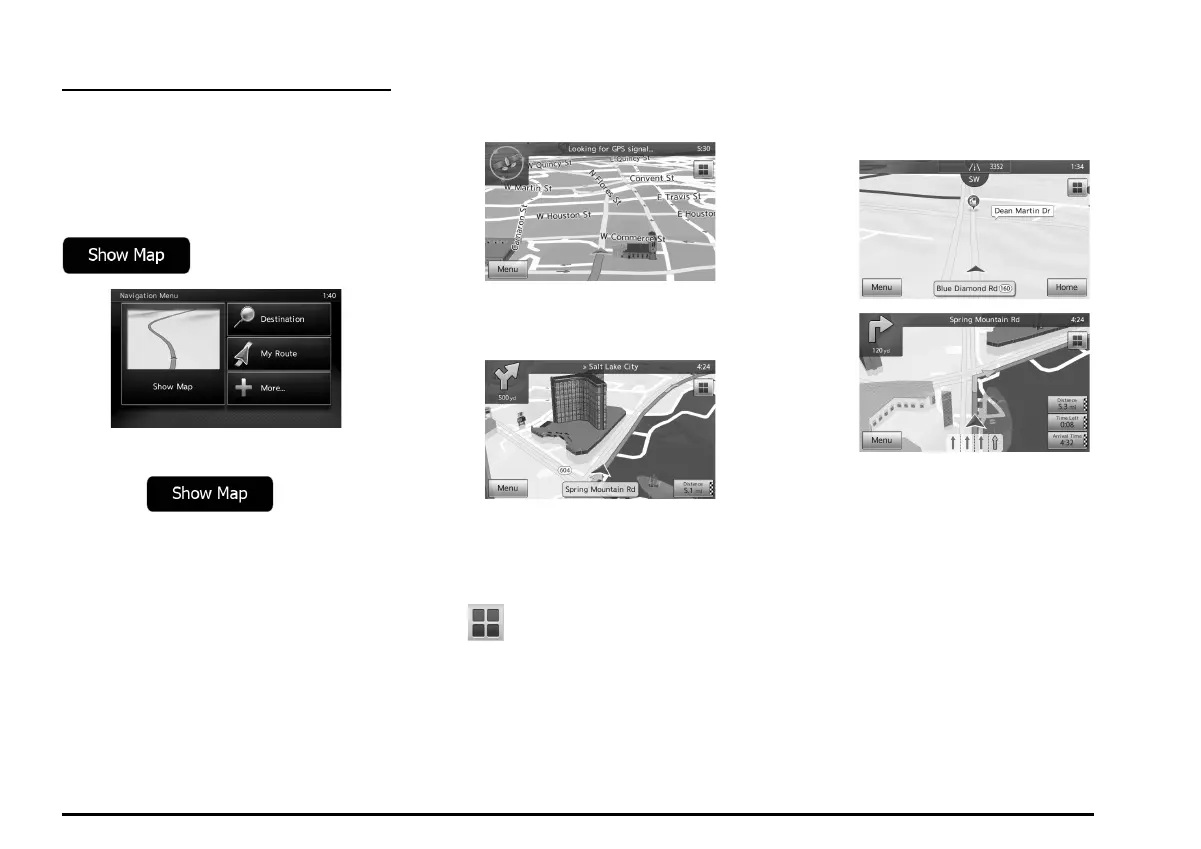
Map screen
q Navigating on the map
The Map screen is the most frequently used
screen of MMES.
A small live map is displayed on the
Navigation menu, as a part of the
button.
To enlarge this small map and open the Map
screen, tap or press the
MAP button to the right of the screen.
This map shows the current position (the
Vehimarker, a red arrow), the recommended
route (an orange line), and the surrounding
map area.
When there is no GPS position, the
Vehimarker is transparent.
You see colored dots circling around a
satellite symbol in the top left corner. The
more green dots you see, the closer you are
to get the valid GPS position.
When GPS position is available, the
Vehimarker is displayed in full color, now
showing your current position.
There are screen buttons and data fields
on the screen to help you navigate.
During navigation, the screen shows route
information.
The
button gives quick access to
frequently used functions. You can change
the available functions in Settings.
By default, only one data field is displayed in
the bottom right corner. Tap this field to see all
route data fields. Tap any of the data fields to
suppress others and display only the selected
one.
The data fields are different when you are
navigating an active route and when you have
no specified destination (the orange line is not
displayed).
205-0010-00_QY-7375M-A_EN.indb 19205-0010-00_QY-7375M-A_EN.indb 19 3/12/2013 9:57:14 AM3/12/2013 9:57:14 AM
 Loading...