Important:Theinformationbelowisprovided
forguidanceonlyandisnotexhaustive.Some
inuencingfactorscanbeuniquetocertainvessels
and/orareasofwaterandmaynotbelisted
below.YoushouldensureyouaccountforALL
factorsthatapplytoyourcurrentsituationwhen
makingcalculations.
Someofthefactorsthatcaninuencevesselheight
areshownbelow:
•Vesseldisplacement(weight)—Avessel’s
height(fromthewaterline)willdecreasewhen
itisfullyladenwhencomparedwithitsunladen
displacement.
•Watertype—Avessel’sheightwilldecreaseby
approximately2%to3%infreshwatercompared
toseawater.
Someofthefactorsthatshouldbetakenintoaccount
whencalculatingaSafetyMarginare:
•Vesselmaneuveringcharacteristics—A
vessel’sheightchangesduetosquat,trim,roll,
pitchandheave.
•Chartaccuracy—Theelectronicchartdatamay
notbeaccurateormayhavechangedsincethe
lastsurvey.
•Weatherconditions—Lowairpressure,and
prevailingwindstrengthanddirectioncanaffect
waterlevel.
SettingthevesselMinimumSafeDepth,
BeamandHeight
FromtheHomescreen:
1.SelectCustomize.
2.SelectBoatDetails.
3.SelectMin.SafeDepth,Min.SafeBeamor
Min.SafeHeight.
4.Enteryourcalculatedminimumsafesettings.
Settingtimeanddatepreferences
Withthehomescreendisplayed:
1.SelectCustomize.
2.SelectTimeandDateSet-up.
3.UsetheDateFormat,TimeFormat,andLocal
Time:UTCmenuitemstosetyourtimeanddate
preferences.
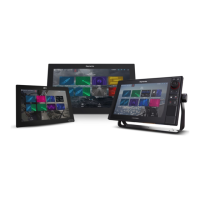
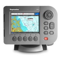
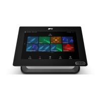
Datamaster
Anysystemcontainingmorethanonenetworked
multifunctiondisplaymusthaveadesignateddata
master.
Thedatamasteristhedisplaywhichservesasa
primarysourceofdataforalldisplays,italsohandles
allexternalsourcesofinformation.Forexample
thedisplaysmayrequireheadinginformationfrom
theautopilotandGPSsystems,usuallyreceived
throughaSeaTalk
ng
orNMEAconnection.Thedata
masteristhedisplaytowhichtheSeaT alk,NMEA
andanyotherdataconnectionsaremade,itthen
bridgesthedatatotheSeaTalk
hs
networkandany
compatiblerepeatdisplays.Informationsharedby
thedatamasterincludes:
•Cartography
•Routesandwaypoints
•Radar
•Sonar
•Datareceivedfromtheautopilot,instruments,the
engineandotherexternalsources.
Yoursystemmaybewiredforredundancywithdata
connectionsmadetorepeatdisplays.Howeverthese
connectionswillonlybecomeactiveintheeventofa
faultand/orreassignmentofthedatamaster.
Inanautopilotsystemwhichdoesnotcontaina
dedicatedpilotcontrolheadtheDatamasteralso
actsasthecontrolfortheautopilot.
Designatingthedatamaster
Forsystemswith2ormoredisplaysthefollowing
taskmustbeperformedonthemultifunctiondisplay
thatyouwanttodesignateasthedatamaster.
Withthehomescreendisplayed:
1.SelectSet-up.
2.SelectMaintenance.
3.SelectDataMaster.
4.Selectthedisplaythatyouwanttodesignateas
thedatamaster.
78
gSSeriesinstallationinstructions

 Loading...


