Do you have a question about the Raymarine NAV 298 and is the answer not in the manual?
Overview of the NAV 298 navigation system and its capabilities.
Explains the purpose and structure of the manual for users.
Guidelines for planning and executing the installation of the NAV 298 unit.
Instructions for safely unpacking and inspecting the equipment upon receipt.
Covers location choice, yoke mounting, and flush mounting the display unit.
Details how to connect power, sensors, and external navaids to the unit.
Explains power requirements and connection procedures for the NAV 298 unit.
Describes how to connect Loran-C and GPS sensors to the NAV 298.
Covers connecting the unit to other navigational equipment via NMEA data output.
Specifies how to establish a proper ground connection for optimal signal quality.
Introduction to the operation chapter, emphasizing ease of use and user-friendliness.
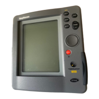
Describes the NAV 298 keyboard layout, key functions, and audio feedback.
Covers fundamental operations like power, backlighting, and auto start-up.
Instructions for powering the unit on and off using the PWR key.
How to adjust or turn the display backlighting on and off.
Explains the unit's start-up sequence and self-test procedures.
Details how to switch between Loran-C and GPS sensor modes.
Guides users on initializing Loran-C and GPS sensors for optimal performance.
Step-by-step instructions for entering the estimated latitude for sensor initialization.
Step-by-step instructions for entering the estimated longitude for sensor initialization.
Explains how to interpret the signal status display for Loran and GPS sensors.
Describes the two primary display modes: Position (POS) and Navigation (NAV).
Details the various Position (POS) display screens available for Loran and GPS.
Explains the POS display screens when using Loran-C mode.
Explains the POS display screens when using GPS mode.
Covers the two Navigation (NAV) display modes used for route following.
Instructions on how to save the current position as a waypoint (Event).
How to select a stored waypoint as a destination and navigate to it.
Methods for entering waypoint data, including Events, Lat/Lon, and TDs.
Provides general information on waypoint storage and memory locations.
Reiteration of saving the current position as an Event for ease of use.
Step-by-step guide for entering waypoint coordinates using Latitude and Longitude.
Instructions for entering waypoint data using Time Difference (TD) coordinates.
Procedures for modifying existing waypoint data in memory.
How to 'erase' waypoints by setting their coordinates to zero.
Configuration of programmable alarms for arrival, anchor watch, and off-course.
Setting an alarm to notify when approaching a waypoint within a specified distance.
Setting an alarm to monitor vessel position while anchored and detect drift.
Setting an alarm to alert if the vessel strays too far from the intended track.
Functionality to instantly store position and navigate back to a man overboard location.
Creating, using, editing, and erasing route plans consisting of multiple waypoints.
Step-by-step guide to create a new route plan by entering waypoints.
Recalling, editing, and erasing saved route plans.
How to select and activate a saved route plan for navigation.
Instructions to deactivate an active route plan.
Procedures for inserting or deleting waypoints within an existing route.
Steps to completely delete a saved route plan from memory.
Displays showing signal acquisition and sensor status for Loran and GPS.
How to check Loran status, including GRI, stations, SNR, and ECD.
Details on interpreting the Signal-to-Noise Ratio (SNR) for loran signals.
Explains the Electronic Circular Diameter (ECD) display for loran signal tracking.
How to check GPS status, including satellites tracked and HDOP.
Accessing and configuring system settings for Loran and GPS sensors.
Configuration options specific to the Loran system, including estimated position and GRI.
Procedure for entering the vessel's estimated latitude and longitude for initialization.
How to manually select a GRI and secondary stations for Loran.
Settings for automatic or manual magnetic variation correction.
Enables automatic magnetic variation correction based on year and location.
How to switch from magnetic to true north display for course and bearing.
Allows manual entry of magnetic variation values for specific locations.
Applying corrections to improve position accuracy, especially for Loran.
Automatic application of Angle of Secondaries (ASF) corrections for Loran.
Manual entry of Time Difference (TD) corrections for position accuracy.
Manual adjustment of Latitude/Longitude coordinates for chart calibration.
Controls the averaging period for speed and course readouts.
Setting speed and distance units for GPS operation (Nautical or Statute).
Activating the simulator mode for practice navigation.
Configuration settings specifically for the GPS sensor system.
Entering the estimated position for GPS sensor initialization.
Setting the current date (Month, Day, Year) for the GPS system.
Entering the local time in 24-hour format for the GPS system.
Inputting the antenna height above sea level for GPS calculations.
Choosing the GPS fix mode (AUTO or 2D) for position accuracy.
Settings for magnetic variation related to GPS operation.
Options for correcting GPS position data, including geodetic datum selection.
Choosing the geodetic datum system for accurate chart calibration.
Manually adjusting GPS Latitude/Longitude coordinates for chart alignment.
Adjusting the averaging period for speed and course readouts in GPS mode.
Setting speed and distance units for GPS operation (Nautical or Statute).
Activating the simulator mode for practice navigation.
Setting the display resolution for Latitude/Longitude readouts.
General tips for keeping the NAV 298 clean and ensuring optimal performance.
Instructions for checking and replacing the fuse in the power cable assembly.
Guidance on replacing the internal lithium battery for memory backup.
Procedures for performing a hard or soft reset to restore default settings.
A guide to diagnosing and resolving common operational issues and symptoms.
Technical specifications and data for the NAV 298 unit.
Summary of key specs: waypoint, route, sensor, and alarm capabilities.
Details on the type of data displayed, including Lat/Lon, TD pairs, and status indicators.
Information on physical dimensions, weight, and operating temperature range.