


J
Justin BellSep 4, 2025
How to fix Raymarine C-Series GPS display very dull?
- BbrittneysullivanSep 4, 2025
If the Raymarine GPS display appears very dull or is hard to view, verify that the PALETTE is set to DAY. Also, check the backlight level.
How to fix Raymarine C-Series GPS display very dull?
If the Raymarine GPS display appears very dull or is hard to view, verify that the PALETTE is set to DAY. Also, check the backlight level.
What to do if Raymarine radar shows “Scanner not responding” message?
To resolve a “Scanner not responding” message on your Raymarine radar, check that the cable connecting the scanner to the radar display unit is securely connected and undamaged.
How to fix Raymarine radar ‘No data’ message?
To resolve a ‘No data’ message on your Raymarine radar, check that the cable connecting the scanner to the display is securely connected and undamaged.
Why are there no depth readings available from Raymarine DSM?
To address the issue of no depth readings from the DSM on your Raymarine system, check the status LED of the DSM unit. Also, check the Gain setup and Transducer frequency. Ensure that the DSM power cable is free from damage and corrosion.
How to fix ‘No data source’ for Raymarine fishfinder?
To solve a ‘No data source’ error for your Raymarine fishfinder, check that the DSM power cable is free from damage and corrosion. Also, verify the DSM is receiving the correct voltage and current. Check the status LED of the DSM unit and ensure the DSM’s connections are secure and correctly connected.
What to do if Raymarine C-Series GPS will not read chart correctly?
To resolve a Raymarine GPS display not reading the chart correctly, first, ensure the chart card has been inserted correctly with the display switched off. Second, verify that the compact flash cartography is correct for the unit.
How to increase chart detail on Raymarine C-Series GPS?
If the Raymarine GPS display does not show enough chart detail, ensure that the appropriate chart card for the area is installed. Also, set the Declutter option to OFF and switch the appropriate features to ON in the Cartography Setup Menu.
What to do if Raymarine GPS has no fix?
If the Raymarine GPS status icon shows no fix, make sure to check the GPS status. Verify that the GPS antenna has a clear view of the sky and check the connections and operation of the GPS antenna.
Why is my Raymarine C-Series showing the wrong location?
If your vessel is not shown in the correct geographical position on the Raymarine GPS display, check the GPS status. Ensure that the display is not in Simulator mode and that the SDGPS setting is switched OFF. You may also need to perform the chart offset operation.
Why Raymarine C-Series GPS display does not power up?
If your Raymarine GPS display isn't powering up, there are a few things you can check: * Ensure the power supply cable is in good condition and that all connections are secure and free from any corrosion. * Inspect the relevant fuses. * Verify that the power source provides the correct voltage and sufficient current.
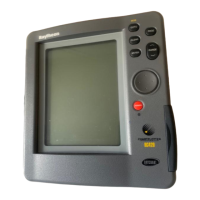
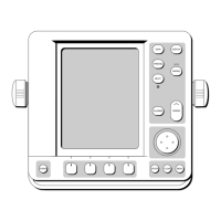
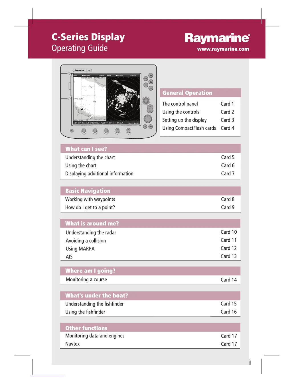
Describes the physical buttons and controls on the device for operation.
Explains how to operate the device using buttons, soft keys, and cursor.
Guide to customizing screen layout, pages, and windows.
Instructions for inserting and removing CompactFlash cards for data.
Explains the purpose and basic elements of the chart display interface.
Details on changing chart orientation and motion mode settings.
Instructions for viewing detailed information on chart features and nearby services.
How to place, manage, edit, and delete waypoints for navigation.
Guide to building and following routes using waypoints.
Explains radar display elements and how to measure range and bearing.
Configuration of guard zones for collision avoidance alarms.
How to use the Mini Automatic Radar Plotting Aid for target tracking.
How to display and interpret Automatic Identification System (AIS) data.
Using the Course Deviation Indicator (CDI) to monitor boat course.
How to interpret fishfinder displays and recognize bottom types.
Adjusting fishfinder settings like range, frequency, and gain.
How to view system data, engine status, and fuel information.
How to view weather forecasts and marine warnings via Navtex receiver.
| Chartplotting | Yes |
|---|---|
| Waterproof Rating | IPX6 |
| WAAS | Yes |
| Weight | Varies by model |
| Display Type | LCD |
| Resolution | 640 x 480 pixels (C70), 800 x 480 pixels (C90W) |
| GPS Receiver | Integrated |
| Networking | NMEA 2000 |
| Chart Compatibility | Navionics |
| Radar Compatibility | Yes, Raymarine radar systems |
| Sonar Compatibility | Yes, Raymarine sonar systems |
| Power Supply | 10-32V DC |
| Dimensions | Varies by model |