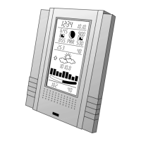
MAIN UNIT Display
THE WEATHER FORECAST
Viewyourpersonal5-daylocalweatherforecastby28distincteasy-to-read
weather symbols.
View Weather Details on-Demand:
HIGH/LOWTEMPERATUREFORECAST
Press MODE repeatedly until HI & LO appears.
Press C/F button located on the back of the Main Unit to select ˚C or ˚F.
AVERAGEHUMIIDTYFORECAST
Press MODE repeatedly until RH% appears.
CHANCE OF PRECIPITATION FORECAST
Press MODE repeatedly until PRECIP% appears.
RAINFALL FORECAST
Press MODE repeatedly until RAIN appears.
Press RAINbuttonlocatedonthebackoftheMainUnittoselectrainfall“mm”or
“inch”unitofmeasurement.
MAXIMUMUVINDEXFORECAST
Press MODE repeatedly until UVI appears.
NOTE:YourUVIindexismeasuredin4-Dayforecastintervals.
UVI1to2
MaximumUVlevelislow.Lowdangerforsunexposure
for the average person.
UVI3to5
MaximumUVlevelismoderate.Moderateriskofharm
from unprotected sun exposure.
UVI6to7
MaximumUVlevelishigh.Highriskofharmfrom
unprotected sun exposure.
UVI8to10
MaximumUVlevelisveryhigh.Veryhighriskofharm
from unprotected sun exposure.
UVI11to15
MaximumUVlevelisextreme.Extremeriskofharmfrom
unprotected sun exposure.
13
12
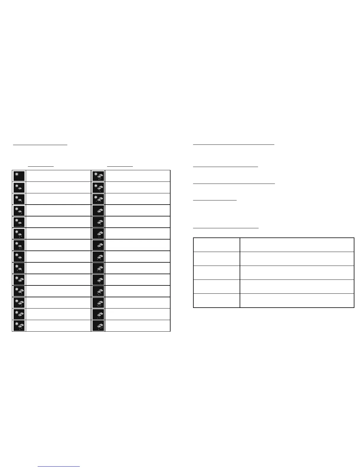
Description Description
Clear Mostly cloudy with sleet showers
Partly cloudy Mostly cloudy with snow showers
Partly cloudy with light rain Mostly cloudy with thunderstorms
Partly cloudy with light sleet Overcast
Partly cloudy with light snow Overcast with light rain
Partly cloudy with showers Overcast with light sleet
Partly cloudy with sleet showers Overcast with light snow
Partly cloudy with snow showers Overcast with showers
Partly cloudy with thunderstorms Overcast with sleet showers
Mostly cloudy Overcast with snow showers
Mostly cloudy with light rain Overcast with rain
Mostly cloudy with light sleet Overcast with sleet
Mostly cloudy with light snow Overcast with snow
Mostly cloudy with showers Overcast with thunderstorms
 Loading...