Do you have a question about the Standard Horizon CP300 and is the answer not in the manual?
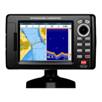
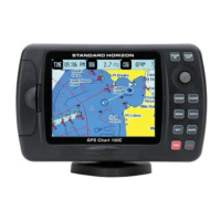
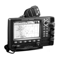
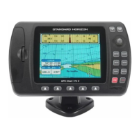
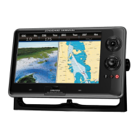
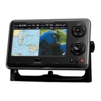
Provides overview of the CP180, CP300, CP180i, CP300i GPS Chart Plotters and their features.
Details the contents included in the package for CP180/CP180i and CP300/CP300i models.
Lists available optional accessories for the GPS Chart Plotters, such as fish finders and video adapters.
Information on Radar antenna units supplied by SI-TEX USA for compatible GPS Chart Plotters.
Instructions for mounting the GPS Chart Plotter unit, including bracket and flush mounting.
Details on using the supplied swivel mounting bracket for installation.
Step-by-step guide for flush mounting the CP180 and CP300 models.
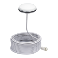
Instructions for mounting the external WAAS GPS antenna for CP180/CP300.
Overview of connecting power, GPS antenna, fish finder, and NMEA devices.
Guidance on connecting the GPS Chart Plotter to a 12VDC power source.
Information on connecting external devices via NMEA for data display.
Explains how to display GPS coordinates on a VHF radio and vice-versa.
Details regarding the optional FF525 Fish Finder and its connection.
Information on SI-TEX Radar Antenna compatibility and connection for US users.
How to connect the GPS Chart Plotter to a PC for data transfer.
Description of the NMEA Data Page for monitoring external device data.
Instructions for connecting and displaying video input on CP300/CP300i models.
Explanation of the Demo Mode for showcasing features, intended for dealers.
Defines the front panel keys and the ShuttlePoint knob for device operation.
Basic operations like power on/off and ShuttlePoint knob usage.
How to set and adjust the automatic time based on GPS data and time zones.
Options for displaying coordinates like Latitude/Longitude, Loran TD, or UTM.
Customizing chart page appearance with color schemes like Sunlight, Normal, Classic, and Night.
Instructions for changing the software and display language.
Using soft keys on CP300/CP300i for quick access to different display pages.
Guide on how to assign custom functions to the soft keys on CP300/CP300i.
Configuration options within the General Setup menu for various device settings.
How to access the Information page for software and device details.
Overview of the INFO key function for searching cartographic objects and services.
Instructions for inserting the C-MAP BY JEPPESEN MAX C-CARD into the plotter.
Accessing and configuring various map display options like zoom type and icon size.
Steps to place a new mark on the chart using the cursor and inputting details.
How to modify existing marks, including changing icons, names, and positions.
How to mark the vessel's position in case of a man overboard emergency.
Procedure for removing a MOB point from the chart and system.
Step-by-step guide to create a route by selecting waypoints on the chart.
How to assign a custom name to a saved route.
Method for creating a route where the last waypoint serves as the destination.
Instructions for creating more than one route.
Procedure to create a route using existing marks on the chart.
How to add a waypoint into an existing route between two points.
Steps to start navigation to a selected route or its waypoints.
Procedure for removing a route from the system's memory.
Configuration options for routes like color, report, send, and thickness.
Setting up and using the track function to record vessel movement.
How to view and reset the trip log information.
Overview of the User C-CARD menu for backup and data transfer.
Customizing the chart display, including single or dual chart views.
Adjusting marine features, depth, land, and underwater object display settings.
Displaying navigation data with compass rose or tape.
Shows a 3D view of the vessel's path for navigation to destinations or routes.
Provides tide information and moon phase data for safe navigation.
Displays information about GPS satellite reception and status.
Shows customizable data windows from external NMEA devices.
Useful for checking NMEA data transmission and reception between devices.
Displays trends for data from connected devices like fish finders or depth sounders.
Enables DSC functions for distress calls and position requests with VHF radios.
Configures NMEA ports for various devices like AIS, fish finders, and MOBILARM.
Customizes coordinate systems, map datums, and orientation resolution.
Configures compass display settings, including magnetic variation and calibration.
Configures audible and visual alarms for arrival, XTE, depth, anchor, and grounding.
Enables simulator mode for practicing navigation and feature usage.
Enables or disables DSC features like Auto Position and Auto Info.
Defines key terms related to the Automatic Identification System (AIS).
Settings for configuring AIS display and alarm parameters.
Procedure to configure the chart plotter to receive AIS data.
How to view basic information about AIS targets by placing the cursor.
Shows a list of AIS targets with basic information and chart location.
Accessing the C-Weather service menu for weather data.
Instructions for connecting the MOBILARM system to the GPS Chart Plotter.
Configuring the GPS Chart Plotter to communicate with the MOBILARM system.
How to verify the MOBILARM system's connection and status.
Running extended auto-tests to diagnose problems with the GPS Chart Plotter.
Clearing internal memory and restoring default settings to resolve issues.
Adjusting screen brightness and keypad backlight.
Testing the C-CARD and its connector for proper functionality.
Testing serial ports for data reception issues and configuring parameters.
Technical details including power, display, memory, and NMEA sentences.
Technical details including power, display, memory, and NMEA sentences.
Specifications for the optional WAAS GPS Receiver.
| Brand | Standard Horizon |
|---|---|
| Model | CP300 |
| Category | GPS |
| Language | English |