Do you have a question about the Standard Horizon CPN700i and is the answer not in the manual?
Steps to turn the chart plotter on and off.
Procedures for safely shutting down the device.
Explains touchscreen operation, gestures, and calibration.
Describes elements and navigation within the menu windows.
How to select and activate menu items using touch or knobs.
Details the various physical controls for chart plotter operation.
Initial setup and basic operation of the chart plotter.
How to switch between Home, Cursor, and 2D/3D chart modes.
Methods to toggle between 2D and 3D chart display views.
How to navigate and select pages and subpages using the menu.
Configuring cursor speed, ship icon, and display settings.
Configuring time zone, daylight saving, and time format.
Changing display format for Latitude/Longitude, Loran TD, or UTM.
Setting the user interface language for menus and data.
Comprehensive list of display customization options in General Setup.
Shortcut menu for essential alarms, track, and AIS configurations.
Details coverage and features of pre-loaded North American coastal charts.
Information on C-MAP 4D cartography features and content.
Features available with the MAX content of C-MAP 4D.
Additional features in the FULL 4D content of C-MAP 4D.
Feature to locate nearest port services based on vessel position.
Locating and viewing information about nearby ports.
Finding and displaying tide station information and graphs.
Locating points of interest by category and type.
Searching for stored marks and waypoints by name.
Entering and viewing specific geographic coordinates on the chart.
Settings related to C-MAP 4D chart display, including window selection.
Selecting which chart window (Chart1 or Chart2) settings apply to.
Placing a new mark on the chart page at a specific location.
Building a route by connecting a sequence of waypoints.
Analyzing a route for potential navigation hazards.
Automatic route calculation between two points, avoiding obstacles.
Marking the current position instantly for MOB situations.
Recording vessel tracks for later review or navigation.
Preparing an SD card for use as a User SD CARD.
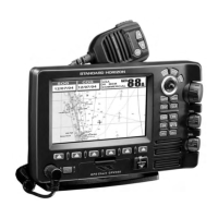
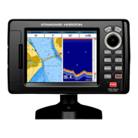
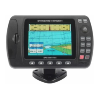
The primary display for chart viewing, navigation, and data.
Selecting display presets for cartographic objects and options.
Configuring GPS source, navigation speed, and differential correction.
Displaying and logging DSC distress calls received from VHF radios.
Customizing coordinate systems, chart datum, and navigation settings.
Setting priority for GPS, Depth, Wind, and Compass data sources.
Simulating navigation scenarios to practice using the chart plotter.
Definitions of AIS system terms like Target, CPA, and TCPA.
Configuring AIS target display, activation range, and alarms.
Displaying C-MAP weather forecast data on the chart.
Steps to activate the P2N Link feature on the chart plotter.
Steps to activate P2N Link on an iOS mobile device.
Connecting to Wi-Fi hotspots and networks.
Step-by-step guide to connecting to a Wi-Fi hotspot.
Configuring network connection between two CPN Series Chart Plotters.
Steps to pair a Bluetooth mouse or keyboard.
Instructions for mounting the chart plotter unit.
Instructions for flush mounting the chart plotter unit.
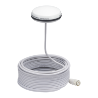
Guidance on installing the external GPS antenna.
Overview of all available connectors and device connections.
Instructions for connecting the unit to the boat's battery supply.
Wiring diagrams and pinouts for NMEA-0183 connections.
Technical specifications for the CPN700i model.
Technical specifications for the CPN1010i model.
Performing extended auto-tests to diagnose problems.
Clearing internal memory and resetting settings to defaults.
Step-by-step guide to updating the system software via SD card.
Explanations and solutions for system update error messages.
| Brand | Standard Horizon |
|---|---|
| Model | CPN700i |
| Category | GPS |
| Language | English |