Do you have a question about the Topcon OS-103 and is the answer not in the manual?
Details on laser product classification (Class 3R, Class 1, Class 2) and EDM device output.
Critical warnings regarding laser exposure, aiming, and seeking medical attention.
Cautions for safe laser operation, including power-off, disposal, and target sighting.
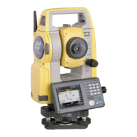
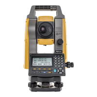
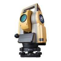
Identification and function of the instrument's various components.
Fundamental operations involving the instrument's keys, screen navigation, and mode switching.
Explanation of how to operate and navigate the instrument's display screens.
Instructions and precautions for charging the instrument's battery.
Method for accurately centering the instrument over a survey point using optical plummet.
Procedure for centering using the laser plummet option.
Procedures for leveling the instrument using circular and electronic levels.
Steps to turn the instrument on and initial screen display.
Setup and use of Bluetooth for connecting with external devices.
Procedures for establishing and managing communication between the OS and companion devices.
Information on connecting the instrument to computers via USB ports.
How to measure the horizontal angle between two points using the 0SET function.
Procedures to set a specific horizontal angle or hold a value.
Measuring angles and exporting the data to external devices in GTS or SET format.
Verifying sufficient signal return for accurate distance measurements, especially over long distances.
Performing simultaneous distance and angle measurements.
Measuring distances and exporting the data to a computer or external devices.
Measuring heights of inaccessible points using the REM function and formula.
Inputting station coordinates and instrument height for coordinate measurements.
Calculating and setting the azimuth angle based on instrument and backsight station coordinates.
Procedure for entering backsight station coordinates.
Procedure for entering a desired horizontal angle for backsight setup.
Procedure for entering a desired azimuth angle for backsight setup.
Calculating and displaying 3D coordinates of measured points using input formulas.
Determining instrument station coordinates (N, E, Z) by measuring known points.
Determining instrument station height (Z) by measuring known points.
Utilizing the guide light's status and colors for target positioning during setting-out.
Measuring distances to set out points accurately using reference direction and distance.
Setting out points by inputting coordinates and measuring angles/distances.
Setting out points at inaccessible locations using REM measurement.
Measuring distance and angle to an offset point to find an unobservable target point.
Measuring angles to offset points to locate a target point.
Measuring offset points by measuring distances to two offset points.
Measuring slope distance, horizontal distance, and angle to targets without moving the instrument.
Setting various observation parameters like distance mode, tilt correction, and coordinates.
Configuring instrument settings such as backlight, power-off timer, and key backlight.
Checking and adjusting the instrument's circular level for proper leveling.
Procedures for checking and calibrating the tilt sensor to correct zero point error.
Measuring and correcting collimation error using angular observations with both faces.
Checking the perpendicularity and positions of the reticle lines.
Checking and adjusting the optical plummet for accurate centering of the instrument.
| Brand | Topcon |
|---|---|
| Model | OS-103 |
| Category | Measuring Instruments |
| Language | English |