English
34
Some useful attributes with preset names are displayed for
each layer type (see table below). It’s up to you whether or not
to create them.
Using “Length” allows the program to automatically assign
the length of a line as one of its attributes. The length of the
line is computed as you walk along the line. The result of the
computation only appears after you have stopped logging the
line, when you review all its attributes. The same is true with
the “Perimeter” and “Area” attributes for a polygon.
Very Important! Once created, the attributes of a layer cannot
be deleted or modified. If you are creating a new layer and
make a mistake in defining one of its attributes, then you will
have to delete the layer and re-create it.
Adding attributes to a layer:
•From the Attributes tab of the layer properties window, tap
the Add... button.
• Enter a name for the attribute using the virtual keyboard.
• Select a type for this attribute. If applicable, set the
additional one or two parameters.
• Tap on the Add button. This takes you back to the
Attributes tab where is now listed the attribute you have
just created.
• Resume the previous four steps until all the attributes
have been created.
Label. This setting is used to select the label you want to see
on the map screen, next to the features collected through that
layer. The label can only be one of the attribute values
pertaining to the feature. Choosing “None” means there
won’t be any label displayed.
Scale. This setting is used to display or hide the layer on the map
screen, depending on the current scale value used. The scale
property of the layer operates as a threshold, which will order
the layer to be hidden if the scale value on the map screen is
less than this threshold.
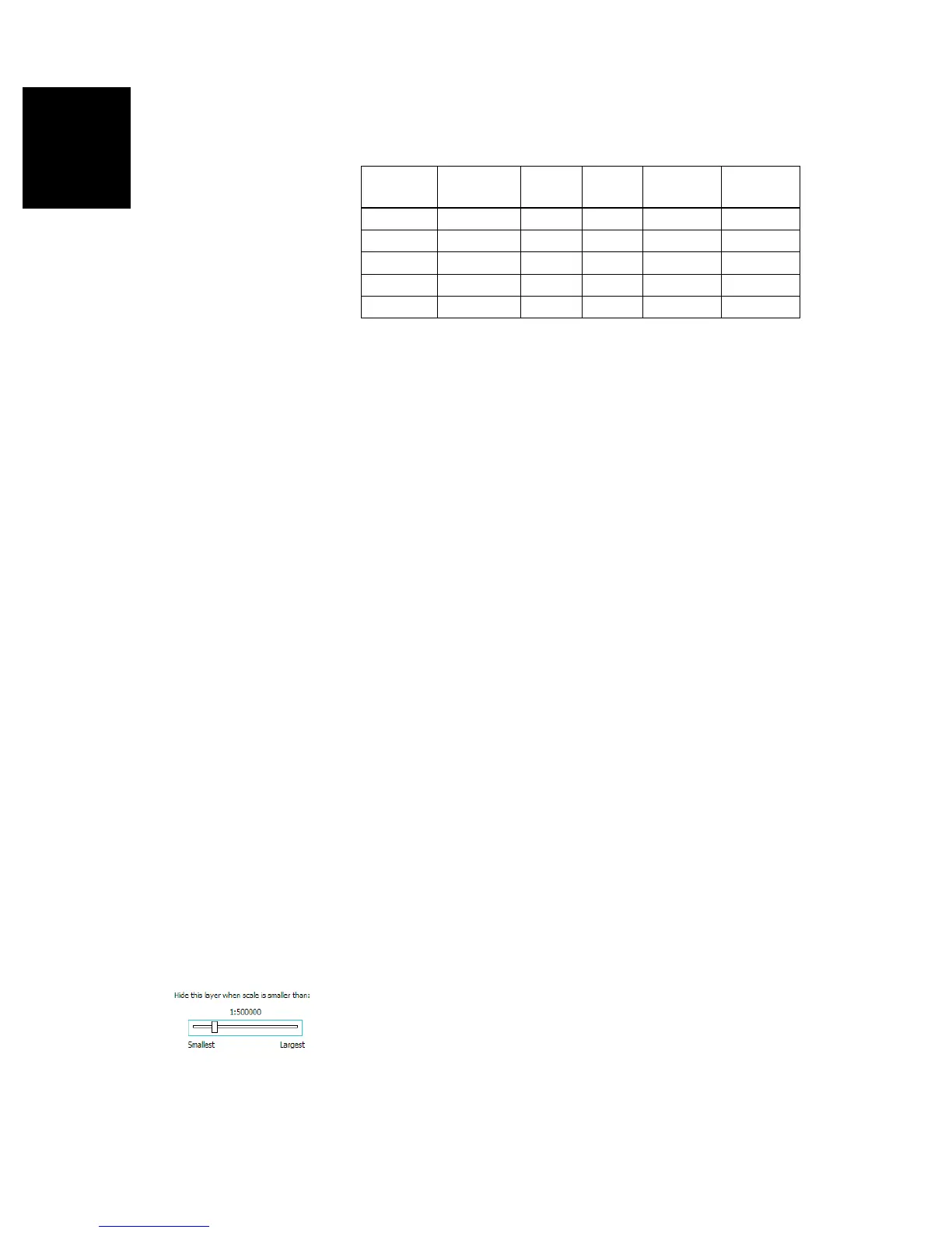
Attribute
Name
Attribute
Type
Point
Layer
Line
Layer
Polygon
Layer
MapInfo
layer
Picture Image • • • •
Sound Voice • • • •
Length Numeric •
Perimeter Numeric •
Area Numeric •