English – 21
– <Certificates>
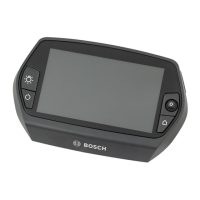
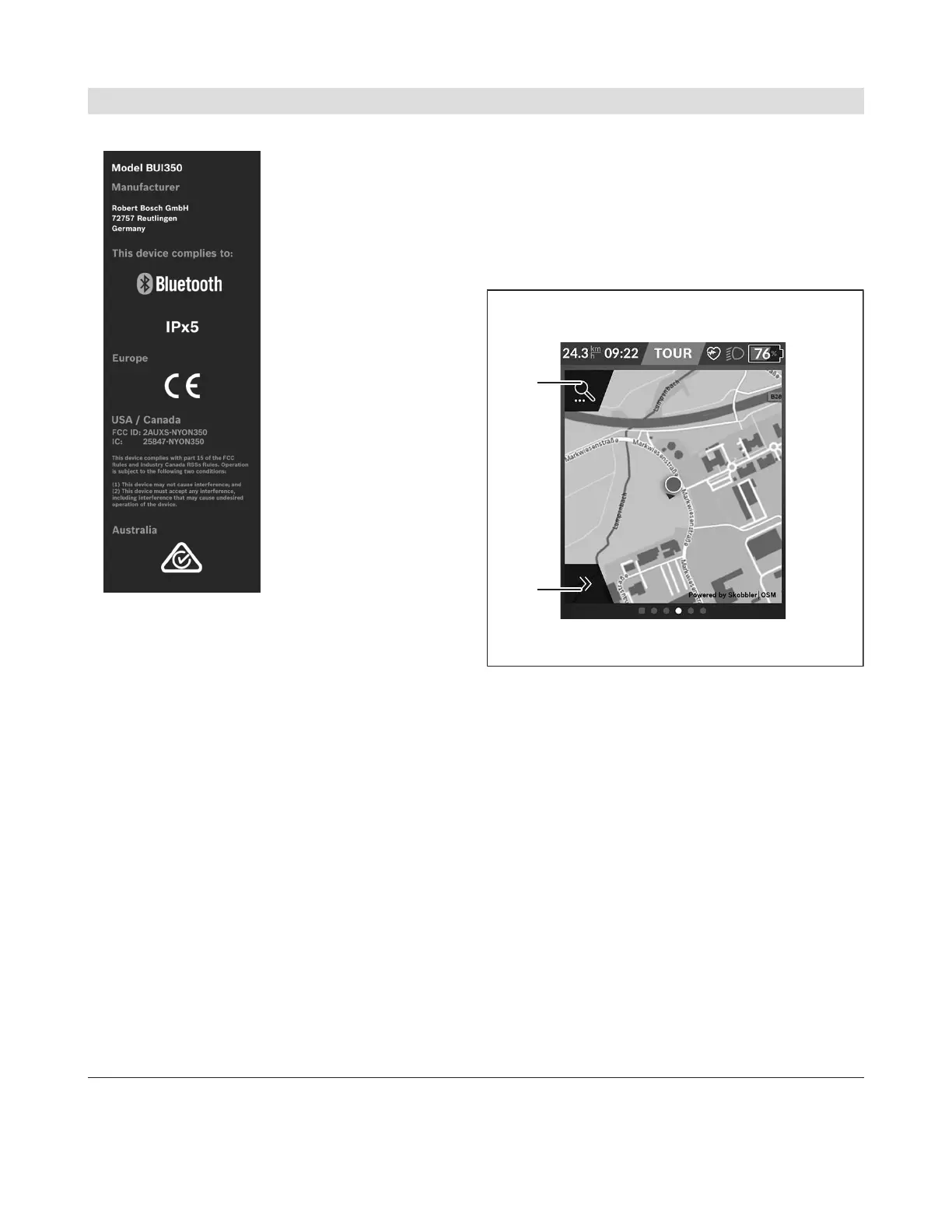
<Map Screen>
The navigation system draws on map material that is
based on OpenStreetMap (OSM).
Whenever you switch on Nyon, it will begin with a
satellite search to enable it to receive GPS signals.
When sufficient satellites have been found, the loca-
tion point changes color from gray to blue. In unfavor-
able weather conditions or locations, the search for
satellites may take a little longer. If no satellites have
been found after an extended period of time, Nyon
will restart.
When searching for satellites for the first time, the
process can take several minutes.
In order to achieve the best possible positional accu-
racy, the first satellite search should be carried out
outdoors. Ideally, you should remain stationary for a
few minutes while this takes place, even if your posi-
tion has already been found.
Once Nyon has determined your location, this will be
shown to you on the map. To increase the size of the
map section, touch the touchscreen with two fingers
and spread them out. To zoom out of a section of the
map, place two fingers on the touchscreen and bring
them together. To move around the map, simply
place two fingers on the touchscreen and move them
across the map. To select a destination, press and
hold a finger against a location on the map.
n1
Navigation search
n2
Navigation functions
In the navigation functionsn2, you can select
your destinations so that you can reach them
using the current state of charge.
While the navigation system is active, the user
is informed about the current assistance mode
they are using and whether they are able to
reach their destination with the current eBike
battery state of charge.
The circle around your location shows how far
you can go, taking into consideration the assis-
tance level set and the terrain ahead with the
current state of charge of the eBike battery. Ad-
justing the assistance level will adjust the radius
of the circle accordingly.
Bosch eBike Systems 1 270 U20 BN2 | (14.03.2023)
 Loading...