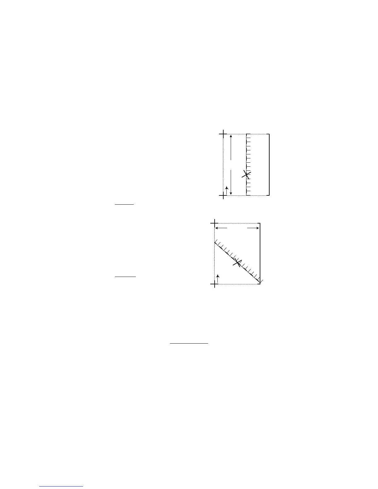
10.2.c -- Latitude Determination
1. Use the small rectangle that completely
surrounds the ‘X’.
2. Place scale vertically, until bound by both
horizontal latitude lines, and touches the
‘X’. (Fig 33)
3. At the ‘X’, add the value indicated by the
scale (00’ 50") to the lowest latitude value
(43° 02’ 30").
Add values as you would when adding time on
a clock.
43° 02’ 30"
+ 00’ 50"
43° 02’ 80" = 43° 03’ 20" N. Latitude
10.2.d -- Longitude Determination
1. Slope the scale until bound by both vertical
longitude lines, and touches the ‘X’. (Fig 34)
· Make sure scale increases with increasing
longitude lines.
2. At the ‘X’, add value indicated by the scale
(1’ 15") to the lowest longitude value (108°
22’ 30").
108° 22’ 30"
+ 01’ 15"
108° 23’ 45" = 108° 23’ 45" W. Longitude
Final position of the ‘X’ is:
43° 03’ 20" N. Latitude
108° 23’ 45" W. Longitude
Follow the same procedures when using different scaled maps (1:100,000, for example).
Just make sure to use the correct scale.
If you do not have a latitude-longitude finder, you may use 10 inches on a ruler. Each inch
represents 15 minutes of latitude or longitude on a 1:24,000 scale map. Ten inches
may not fit, as in section 10.2.c, Latitude Determination
, so you must slant the ruler until the
10 inches are completely enclosed by the 2’ 30" lines, and ruler is next to the position.
18