to locations on its surface. A position on Earth is measured in degrees ( ° ), minutes ( ‘ ) and
seconds ( " ), where 60 second = 1 minute & 60 minutes
= 1 degree. Very similar to time on a clock. Measurements
begin at the Equator (0° latitude) and the Prime Meridian
(0° longitude).
In Figure 30, the position is read:
45° 00’ 00" N. Lat. = 45 degrees, 0 minutes and 0
seconds north latitude
60° 00’ 00" W. Long. = 60 degrees, 0 minutes and 0
seconds west longitude.
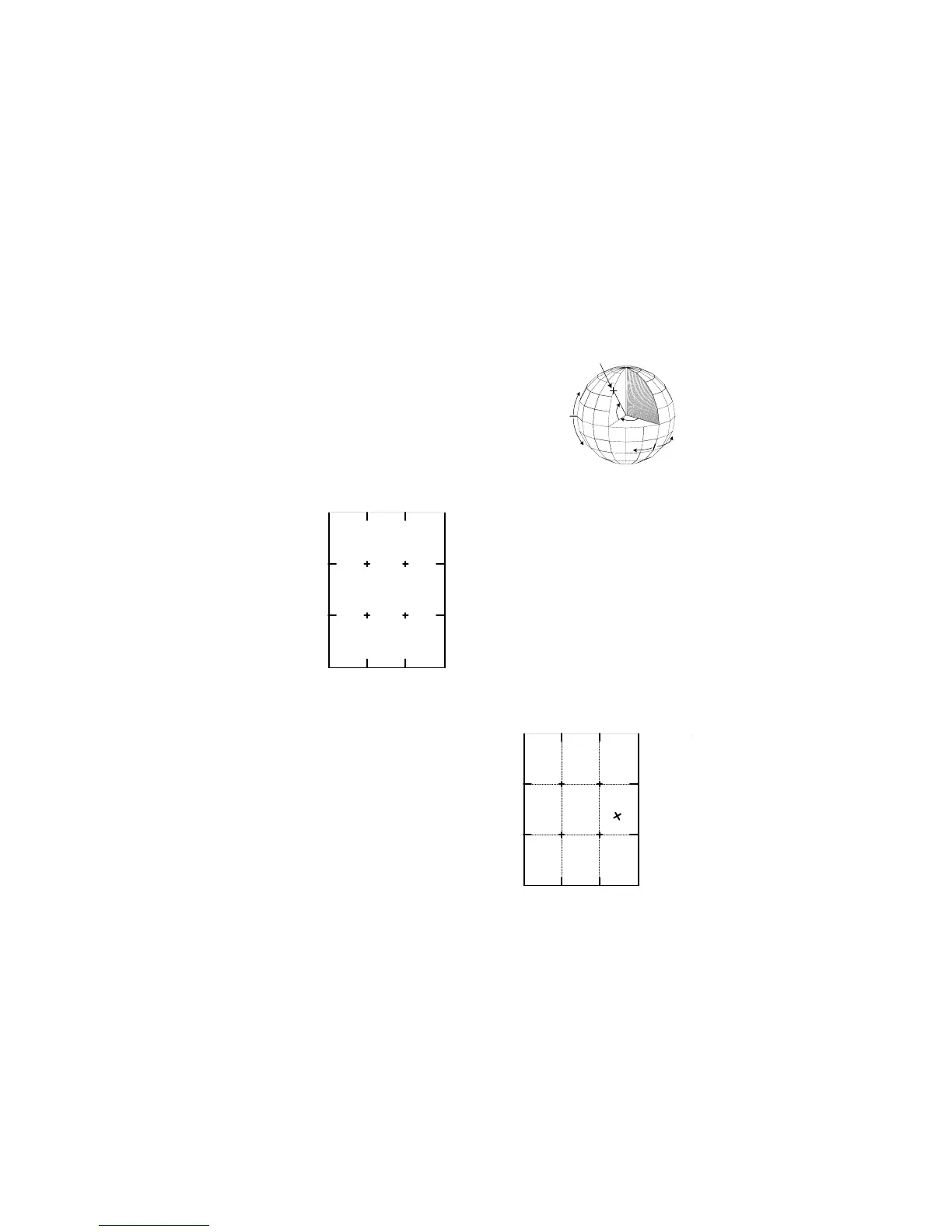
10.2.a -- Latitude And Longitude
Coordinate From A Topo-Map
All 7.5 minute USGS topo-maps are
bound by 7.5 minutes of latitude and 7.5
minutes of longitude. The four corners
of the map are identified by coordinates
in latitude and longitude. In addition, tick
marks are placed every 2’ 30" around
the margin of the map, with crosses in
the middle. The 4 crosses identify the
intersections of the 2’ 30" tick marks.
(Fig 31)
10.2.b -- Map Preparation
1. Identify the tick marks, and draw lines
connecting the tick marks. (Fig 32)
· The lines produce 9 small
rectangles.
2. Identify and mark a position on the
map with an ‘X’.
3. Use a 1:24,000 latitude-longitude
scale to determine the coordinate
position of the ‘X’ (not available with
the Eclipse 8099).
17