Do you have a question about the Canon GP-E2 and is the answer not in the manual?
Describes camera compatibility for full receiver features.
Outlines features available on cameras without specific settings.
Instructions for specific camera models regarding firmware updates for compatibility.
Explains how the receiver geotags images and adds shooting direction.
Details how to log routes and view them on a map.
Describes how to set camera time using GPS signals.
Explains how to view shooting locations and routes using Map Utility.
Details geotagging images using logged information on a computer.
Guidance on using storage and carrying cases for the receiver.
Information on selecting and using the correct connecting cables.
Explains the meaning of symbols used in the manual.
Lists fundamental assumptions made throughout the manual.
Provides information on the expected battery life of the receiver.
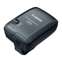
Explains the function of the receiver when set to the <ON> position.
Details the receiver's function when set to the <LOG> position for route logging.
Describes the LED indicator blinking patterns after GPS signal acquisition.
Explains how GPS signal status is displayed on the camera.
Lists locations where GPS signal reception may be poor or inaccurate.
Provides additional notes regarding GPS signal acquisition and usage.
Guides users on how to view GPS information on the camera.
Specific instructions for EOS 7D users regarding geotagging.
Details the type of GPS information recorded for geotagging images.
Explains how location information is recorded and saved.
Details the log file capacity based on different positioning intervals.
Provides estimated battery life based on chosen positioning intervals.
Explains how to view the camera's direction during shooting.
Guides users through the process of calibrating the digital compass.
Describes the automatic time setting feature using GPS signals.
Explains the creation and behavior of log files based on UTC time.
Describes the Map Utility software for viewing locations and geotagging.
Explains ImageBrowser EX's role in updating Map Utility.
Step-by-step guide for installing the provided software.
Instructions on how to copy and view PDF manuals from the disc.
Lists compatible camera models and their feature availability.
Details the types of data used for geotagging images.
Specifies the reception frequency of the GPS receiver.
Lists the available positioning interval settings.
Specifies the logging mode protocol used by the receiver.
Describes how the camera time is adjusted using GPS data.
Mentions the sensors used for the digital compass function.
Describes the terminal used for connecting interface cables.
Details the power source requirements for the receiver.
Provides the physical dimensions of the GPS receiver.
States the weight of the GPS receiver.
Specifies the operating temperature range for the receiver.
Indicates the operating humidity limits for the receiver.
Lists the software included with the GPS receiver.
Highlights critical safety warnings to prevent severe harm or fatalities.
Lists cautions to prevent personal injury or damage to the equipment.
Provides guidance on how to handle the receiver properly.
Provides regulatory compliance information from FCC and Industry Canada.
Details compliance with Canadian radio interference regulations.
Specifies the warranty terms for USA and Canada.
Section for recording current ownership and interested products.
| Interface | - |
|---|---|
| Sensitivity | - dBmW |
| Channels quantity | - channels |
| On/off switch | Yes |
| Product color | Black |
| Rechargeable | No |
| Battery type | AA |
| Weight | - g |
|---|