Chapter 2: Operation
Settings 19
22222
Operation
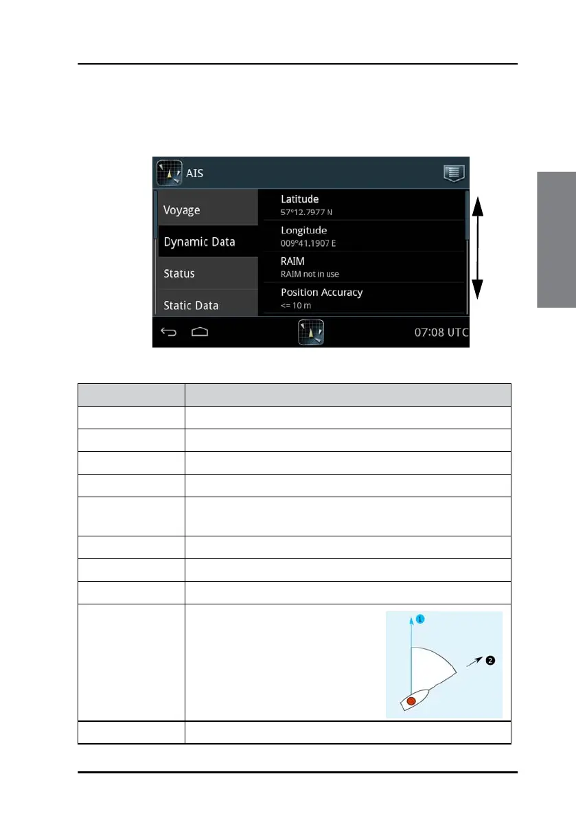
Dynamic Data (read only)
The dynamic data is provided by the ship’s sensors.
Figure 15: Settings – Dynamic data (read only)
Swipe
up or
down
Item Description
Latitude Current value for latitude.
Longitude Current value for longitude.
RAIM Indication of RAIM being used or not.
Position accuracy > 10 m or <= 10 m.
Position quality Indication of position quality derived from Position
accuracy, RAIM and Position time stamp.
Time stamp Time stamp for latest received position update in seconds.
COG Course over ground, relative to True North.
SOG Speed over ground.
Heading 1 – True North
2 – Heading
Rate of turn Right or left, from 0 to 720 degrees per minute.
Table 3: Items in Dynamic Data