42
©
2015 DJI. All Rights Reserved.
Flight
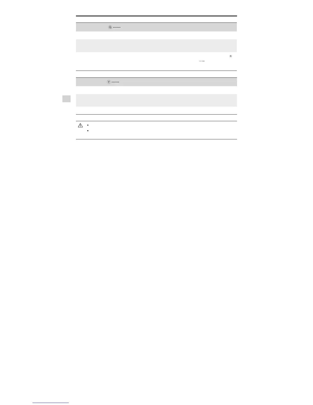
GPS Signal Strong Blinking Green
Flight Limits DJI Pilot App Aircraft Status Indicator
Max Height
Flight altitude must be under
the set height.
Warning: Height
limit reached.
None.
Max Radius
Flight distance must be within
the max radius.
Warning: Distance
limit reached.
Rapid red flashing
when close to the
max radius limit.
GPS Signal Weak Blinking Yellow
Flight Limits DJI Pilot App Aircraft Status Indicator
Max Height
Flight height restricted to
120m and under.
Warning: Height limit
reached.
None.
Max Radius No limits
If you fly out of the limit, you can still control the Inspire, but cannot fly it further.
If the Inspire flies out of the max radius in Ready to Fly (non-GPS) mode, it will fly back within range
automatically.
Flight Restriction of Restricted Areas
Restricted areas include airports worldwide. All restricted areas are listed on the DJI official website at
http://www.dji.com/fly-safe/category-mc. Restricted areas are divided into category A and category B. Category
A areas cover major international airport such as LAX and Heathrow, while category B areas includes smaller
airports.
Category A Safety Zone
(1) The category A “safety zone” is comprised of a small “no-fly zone” and a range of “restricted-altitude zones”.
Flight is prevented in the “no-fly zone” but can continue with height restrictions in the restrict- ed-altitude zone.
(2) 1.5 miles (2.4 km) around a designated safety zone is a no-fly zone, inside which takeoff is prevented.
(3) 1.5 miles (2.4 km) to 5 miles (8 km) around restricted areas are altitude restricted, with maximum alti- tude
going from 35 feet (10.5 m) at 1.5 miles (2.4 km) to 400 feet (120 m) at 5 miles (8 km).
(4) A “warning zone” has been set around the safety zone. When you fly within 320 feet (100m) of the safety
zone, a warning message will appear on the DJI Pilot App.
 Loading...
