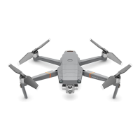
18
©
2017 DJI All Rights Reserved.
1R)O\=RQHV
<RXVKDOOEHVROHO\UHVSRQVLEOHIRUDOO\RXUEHKDYLRUVZKHQÁ\LQJZLWK'-,
DLUFUDIW
%+*UBLFTnJHIUTBGFUZTFSJPVTMZBOEIBTUIFSFGPSFEFWFMPQFEWBSJPVTBJET
UPIFMQVTFSTDPNQMZXJUIMPDBMSVMFTBOESFHVMBUJPOTXIJMFnZJOH
+RZHYHUWKH
DLGVDUHQRWDEOHWRKHOS\RXDYRLGSHQDOW\RUSXQLVKPHQWLI\RXYLRODWHORFDO
ODZVRUUHJXODWLRQV
8FTUSPOHMZSFDPNNFOEUIBUZPVVQEBUFUIFmSNXBSFUPUIF
latest version to ensure the following features are fully updated:
No Fly Zones
1. No Fly Zones include but are not limited to major airports around world, borders
CFUXFFOUXPTPWFSFJHODPVOUSJFTPSSFHJPOTNBKPSDJUJFTSFHJPOTFUD
5IFSFMFWBOUJOGPSNBUJPOPG/P'MZ;POFTJTMJTUFEPOUIFPGmDJBM%+*XFCTJUFBU
IUUQXXXEKJDPNnZTBGFOPnZBOEJTTVCKFDUUPQFSJPEJDVQEBUFTJOMJOFXJUIUIF
latest regulatory requirements without prior notice.
3. Some No Fly Zones are comprised of several zones. Each zone features circles
of various sizes. The aircraft will NOT be able to take off in the inner most zone of
UIF/P'MZ;POFBOEXJMMEFTDFOEUPUIFTQFDJmFEBMUJUVEFXIFOJUBQQSPBDIFT
the edge of the inner most zone. Ground station functionality is disabled when
the aircraft is within a No Fly Zone.
4. Users are NOT able to set up waypoints within No Fly Zones.
Altitude Limit
1. Fly NO higher than 120 meters (400 feet) above ground level and stay away from
any surrounding obstacles.
2. If you intend to fly above the default altitude limit, you are required to accept
the prompted disclaimer to enable the new altitude limit. If a new altitude limit is
TFUZPVGVSUIFSVOEFSTUBOEBOEBHSFFUIBUEBUBJODMVEJOHCVUOPUMJNJUFEUPnJHIU
telemetry data and altitude limit changes could be uploaded to and maintained on
a DJI-designated server.
 Loading...