Do you have a question about the Furuno FCR-21x9-BB and is the answer not in the manual?
General advice and information for users, including manual authorship and system notes.
Critical safety warnings regarding operation and hazards like electrical shock and radiation.
Information on the dangers of radar antenna emissions and safe distances.
Safety precautions related to potential hazards and equipment handling.
Information regarding warning labels attached to the equipment and their importance.
Overview of the marine radar series capabilities, compliance, and main features.
Explanation of signal processing functions like interference rejector and echo averaging.
Guidelines for preventing virus infections when updating charts or connecting networks.
Overview of system components and connections for various marine radar models.
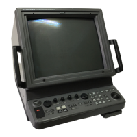
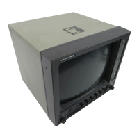
Description of the main system units and their functions, including control units.
Procedure for powering the radar system on and off, including warm-up details.
Instructions for adjusting display brightness manually using controls or knobs.
Explanation of the three operating modes: Radar, Chart Radar, and Chart modes.
Overview of the radar display layout, including operational buttons and indicators.
Description of the InstantAccess bar's functions for quick access to controls.
Guide to configuring navigation sensors and selecting data sources for the radar.
Procedure for entering ship speed data automatically or manually.
Instructions for inputting heading data automatically or manually.
Guide to creating, disabling, restoring, and activating user profiles for custom settings.
Procedure for initiating radar transmission after system warm-up.
Instructions for adjusting the radar receiver tuning manually or automatically.
Explanation of available presentation modes like Head-up, North-up, and Course-up.
Procedure for selecting the radar range scale and understanding range ring intervals.
Guide on adjusting radar receiver sensitivity (gain) for optimal echo display.
Instructions for reducing sea clutter using automatic or manual A/C SEA controls.
Guide on reducing rain clutter using automatic or manual A/C RAIN controls.
Using offset EBL to measure range/bearing and assess collision risk.
Explanation of target trail features, indications, and management options.
Guide on using PI lines for maintaining constant distance from coastlines or ships.
Instructions for setting up picture presets for various navigation situations.
Procedure to show or hide the Target Tracking (TT) display.
Guide on entering ship speed data for TT operation, including echo-referenced input.
Explanation of automatic target acquisition and how to enable it.
Instructions for manually acquiring targets using the radar system.
Procedure for manually entering set and drift data for accurate vector calculations.
Information on the TT CPA/TCPA alarm for collision risk assessment and alerts.
Details on the TT lost target alarm, how to enable/disable it, and set filters.
Steps to display or hide Automatic Identification System (AIS) targets on the screen.
Instructions for filtering unnecessary AIS targets to reduce screen clutter.
Procedure to convert sleeping AIS targets to active targets for vector display.
Explanation of the AIS CPA/TCPA alarm for collision risk and dangerous target alerts.
Information on AIS lost target alarms, how to enable/disable, and set filters.
Procedure for adding and displaying marks and lines on radar maps for navigation.
Instructions for erasing individual marks, lines, or areas from radar maps.
Explanation of ship's track recording, setup, and management.
Overview of the chart display interface areas and their functions.
Details on the types of electronic charts supported by the system (S-57, CM-93).
Guide to selecting between Radar, Chart Radar, and Chart modes.
Steps to select Voyage Navigation, Chart Maintenance, or Voyage Planning modes.
Procedure for changing the chart display scale for better detail.
Guide to selecting display modes like North-up or Course-up for chart viewing.
Explanation of how to reset the true motion display to maintain ship position visibility.
Instructions for managing routes and user charts across different navigation modes.
Guide on using Variable Range Marker and Electronic Bearing Line for measurements.
Steps for preparing charts and routes, including updates and alert settings.
Procedure for installing chart licenses, including automatic and manual methods.
Instructions for installing public keys required for S57 chart authorization.
Procedure for loading chart data from CD ROM or other media via auto load.
Guide to viewing chart cell coverage and information using the chart catalog.
Instructions for manually updating charts, including inserting, deleting, and modifying objects.
Guide on navigating charts using range, off-center, and scroll functions.
Instructions for managing the display of chart features like contours and symbols.
Guide to controlling the display of various symbols and features via the Symbol Display menu.
Explanation of how to use predefined IMO chart display settings for standard views.
Overview of S57 chart system, including data dependency, updates, and legal aspects.
Information on permanent warnings displayed for chart update status and permit validity.
Guidance on using chart viewing dates and seasonal features for accurate chart display.
Information about the Admiralty Information Overlay feature and its display.
Overview of the C-MAP cartographic service and its chart database capabilities.
Procedure for registering the system to use the C-MAP database with an eToken.
Instructions on applying for chart licenses, including purchase and subscription types.
Common problems and solutions for installing C-MAP software or charts.
Explanation of the C-MAP chart display priority and legend information.
Explanation of how chart alerts function and how to set safety contours.
Procedure for activating own ship check using a check area for safety calculations.
Guide to calculating chart alerts for planned routes based on danger areas.
Instructions on how the route monitor facilitates safe route usage and alerts.
Introduction to route planning, including plan components and main functions.
Step-by-step guide for creating a new route plan for navigation.
Instructions for changing waypoint positions and other data within an existing route.
Explanation of the SAR feature for search and rescue operations.
Guide to optimizing routes based on strategies like max speed, time, profit, or cost.
Procedure for deleting created routes from the system.
Overview of user charts as overlays for safety-related objects and areas.
Instructions for creating custom user charts with various objects and features.
Guide on editing objects within a user chart, including moving and inserting points.
Procedure for deleting user charts from the system.
Procedure for selecting a route to be actively monitored during navigation.
Instructions on how to actively monitor a selected route using the Route Information box.
Guide on using PI lines for maintaining constant distance from coastlines or ships.
Explanation of the Check Area feature for safe navigation and own ship checks.
Procedure for setting and using the anchor watch feature to detect ship drifting.
Explanation and setup for the Under Keel Clearance monitoring feature.
Overview of the Consistent Common Reference System and its functions.
Guide to choosing and configuring navigation sensors for system use.
Explanation of how the system selects position sources (primary/secondary).
Information on how the system selects sources for navigation data like heading and speed.
Procedure for fine-tuning ship's position using radar, echo targets, and chart material.
Information on sending and managing AIS safety messages for communication.
Explanation of Navtex messages and how to receive and manage them.
Overview of Target Tracking display symbols, data, and alarm filters.
Information on AIS display symbols, voyage data, filtering, and activation settings.
Procedure for recording user events and position observations into logs.
Information on the voyage log, its contents, and how to set logging conditions.
Explanation of the Danger Targets Log for storing dangerous radar and AIS targets.
Explanation of the alert system, categories, display formats, and icons.
Information on viewing and managing the system's alert list and filtering alerts.
Guide to displaying and searching the alert log for detailed information.
Setting critical ship and route parameters for navigation system performance.
Overview of the mini conning display for heading, speed, and rudder information.
Procedure for exporting setting data, routes, user charts, and radar maps to USB.
Instructions for importing setting data, routes, user charts, and radar maps from external media.
Procedure for running system self-tests to check Processor Unit operation.
Settings for buzzer volume, key beep volume, and scrollwheel rotation direction.
Guide to performing display tests to check monitor color and pattern display.
Key topics for maintaining the Common Reference System, including offsets.
Factors affecting system accuracy, including gyro error and sensor settings.
Guidelines for regular maintenance, including cleaning and checks.
Procedure for replacing fuses to protect units from overvoltage or faults.
Common faults and remedies for restoring normal operation of the radar system.
List of consumable parts in the antenna unit, monitor, processor, and sensor adapters.
Hierarchical structure of the radar system's menu options and settings.
Access to initial system settings for calibration, display, and alerts.
Information display for own ship status, including offset and TM reset.
Overview of chart display functions, including chart types and modes.
Functions for managing radar map marks, lines, and objects.
Explanation of the information box displaying navigation data and route status.
Glossary of abbreviations used throughout the marine radar manual.
Graphical representation and description of symbols used on the radar display.
Visual guide to symbols used for marks and lines in radar maps for IMO and B-type systems.
Technical overview of the system's digital interface, including sentence formats.
Table explaining data indication colors and meanings for navigation parameters.
Comprehensive technical specifications for the marine radar models.
List of available radar models with their frequency band and monitor unit.
Technical data on antenna beam width and sidelobe attenuation for X-band and S-band.
Specifications for the output power of various radar transceiver units.
Details on minimum range, range discrimination, and accuracy for radar displays.
Specifications for the EC-3000 processor unit, including serial I/O and ports.
Information on power supply requirements for monitor units and processor units.
| Frequency | 9410 MHz ± 30 MHz |
|---|---|
| Transmitter Power | 4 kW |
| Rotation Speed | 24 RPM |
| Power Supply | 24 VDC |
| Range Scales | 0.125 to 96 NM |
| Beamwidth | 25° Vertical |
| Display | 10.4-inch LCD |
| Antenna Length | 1.2 m (4 ft) |