Do you have a question about the Furuno MFDBB and is the answer not in the manual?
Scrolls the radar or chart plotter display in a specified direction.
Toggles between 2D and 3D display modes for enhanced visualization.
Resets the display to center the 'own ship' icon.
Navigates the cursor across the display screen.
Controls for powering the equipment on and off.
Adjusts screen brightness and panel illumination.
Displays context-sensitive soft keys for current mode.
Retrieves detailed information about specific objects on screen.
Aborts the last entered command or selection.
Accesses contextual menus for various functions.
Adjusts the zoom level or range of the display.
Adds a new point by placing the cursor.
Marks the current location as a saved point.
Defines a navigation path by linking multiple points.
Sets a Man Overboard marker at the current location.
Navigates and selects options within the system menus.
Changes the currently active screen or function.
Chooses the desired display mode or screen layout.
Fine-tunes radar sensitivity and filters for clarity.
Controls the visibility of data overlays on the display.
Sets the system's audio output level.
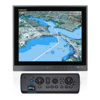
Explains the function of physical buttons and their dual operations.
Details operation of rotary encoder and context-sensitive soft keys.
Describes cursor functions, states, and usage.
Provides guidelines for safe and effective SD card management.
Step-by-step instructions for inserting an SD card.
Step-by-step instructions for removing an SD card.
Adjusts the display zoom level (increase or decrease range).
Moves the chart or radar display content.
Resets the display to center the 'own ship' icon.
Sets display orientation: Head-up, North-up, or Course-up.
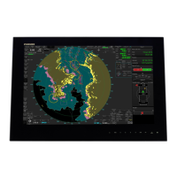
Explains the elements visible on the chart plotter screen.
Details information related to map data and features.
How to obtain simple and detailed information about map objects.
Controls visibility of map layers and text information.
Resets cartographic display settings to factory defaults.
Displays tidal current and tide graph information.
Marks a point at the cursor or own ship's position.
Sets a Man Overboard marker at the current location.
Navigates the vessel to a selected point.
Manages saved points, including editing and selection.
Defines a navigation path by linking multiple points.
Navigates the vessel along a pre-defined route.
Explains the elements and indicators of the radar screen.
Calculates the range to a selected radar target.
Determines the bearing of a selected radar target.
Configures an alarm zone for detecting approaching targets.
Deactivates a previously set guard zone.
Steps to manually track targets using ARPA.
Explains the meaning of various ARPA target symbols.
Displays detailed information for tracked targets.
Sets and manages collision risk (CPA/TCPA) alarms.
Manages target tracking settings and history.
Controls the activation and deactivation of the AIS system.
Identifies and explains symbols used for AIS targets.
Manages AIS target display, history, and filtering.
Configures alarms for AIS targets within a specified distance.
Displays detailed information for selected AIS targets.
Overview of the fish finder screen elements and indicators.
Chooses between automatic and manual operating modes.
Details manual adjustments for range, gain, and clutter.
Sets the sonar operating frequency (Low, High, or Dual).
Explains different zoom functions for sonar data analysis.
Measures individual fish depth and length.
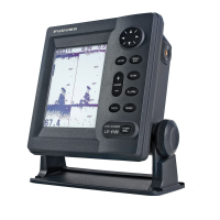
| Brand | Furuno |
|---|---|
| Model | MFDBB |
| Category | Marine Equipment |
| Language | English |