Do you have a question about the Garmin GPSMAP 175 and is the answer not in the manual?
Lists standard and optional items included with the GPSMAP 175 unit.
Provides critical safety warnings and cautions for using the GPSMAP 175.
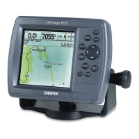
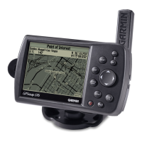
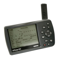
Details the physical components and display of the GPSMAP 175 unit.
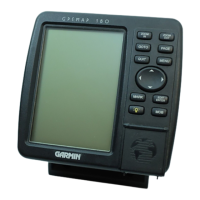
Explains the function of each button on the GPSMAP 175 keypad.
Describes the process and requirements for the GPS receiver to acquire satellite signals.
Guides the user through the initial setup process for first-time use of the GPSMAP 175.
Instructions for powering on the unit and adjusting screen contrast and backlighting.
Introduces the status page and how to enter simulator mode for practice.
Explains how to navigate between pages and introduces the position page display.
Details the procedure for marking and saving the current GPS position as a waypoint.
Overview of the map page, its display elements, and cursor functions.
Instructions on how to use the map cursor for navigation and interaction on the map display.
Explains how to use the GOTO key to select destinations and start navigation.
Covers setting up the simulator and adjusting map scales for better viewing.
Guides on how to review existing and create new waypoints directly from the map.
Overview of the navigation page for steering guidance and route display.
Details on adjusting speed, course, and data fields on the navigation page.
Discusses the active route page and accessing the main menu.
How to access the track submenu and clear the recorded track log.
Instructions on how to properly turn off the GPSMAP 175 unit.
General introduction to the status page and its displayed information.
Details the various receiver status conditions and their meanings.
Lists and explains the context-sensitive options available on the status page.
Explains the information displayed on the position page.
Details the options available for customizing the position page display.
Comprehensive overview of the map page features and data displays.
Explains the different map display modes (position and cursor).
Detailed instructions on using the map cursor for navigation and interaction.
How to select map scales and understand zoom-related warnings.
Customization options for the map page, including display and measurement tools.
How to configure map display items and set map orientation.
Options for map calibration and setting display colors.
Customizing the number of data fields and their content on the map page.
Explains the navigation page for steering guidance to a destination.
Options for CDI scale and customizing the navigation page display.
Details on changing data fields and configuring highway display.
Introduction to the main menu, providing access to system functions.
Explains methods for creating waypoints using the MARK key.
Step-by-step guide on using the MARK key for waypoint creation.
How to create waypoints by pointing on the map or entering text.
Creating waypoints by specifying range and bearing from existing points.
Procedures for reviewing, editing, and renaming stored waypoints.
Options for editing, renaming, or deleting waypoints from the definition page.
Accessing waypoint submenus, including the nearest waypoints list.
Setting up proximity waypoints and alarms for hazard avoidance.
Creating waypoints by coordinates and managing the waypoint list.
How to select a destination using the GOTO function from lists or the map.
Explains additional GOTO options like TracBack, nearest waypoints, and route selection.
Details on Man Overboard (MOB) and TracBack navigation features.
In-depth explanation of activating and using the TracBack feature.
Step-by-step guide to creating a new route directly on the map display.
Procedures for reviewing and editing routes graphically on the map.
Explains how to insert new waypoints and edit routes via text.
Options for editing routes, including inserting, removing, and changing waypoints.
Overview of the route list page and available route management functions.
Options for clearing, copying, and deactivating routes from the list.
Details of the active route page and waypoint navigation information.
Options for managing the active route, including inversion and data field customization.
Configuration options for recording track logs and using TracBack.
Planning trips and calculating fuel consumption between waypoints.
Planning cumulative totals for route legs and entire routes.
Calculating sunrise/sunset times and configuring system settings.
System setup options including local time, tones, display contrast, and backlight.
Setting up position format, navigation units, and heading preferences.
Further navigation setup for CDI scale, map datums, and velocity filters.
Configuring timers and various audible alarms for navigation.
Setting up interfaces for external devices and data transfer.
Configuring NMEA formats and tuning DGPS stations.
Instructions for installing and removing G-chart cartridges.
Explains how to use G-chart cartography and understand map outlines.
Information on installing batteries and connecting external power.
Explains how battery strength is displayed and provides battery safety tips.
Details on the optional Ni-Cad battery pack, charging, and disposal.
Wiring diagram for connecting power/data cables and unit specifications.
Supported NMEA formats, DGPS information, and antenna connection.
Instructions for mounting the GPSMAP 175 unit using the bracket.
Detailed physical and performance specifications of the GPSMAP 175.
Lists and explains various system messages displayed by the GPSMAP 175.
Continues the list of system messages with their explanations.
Defines key GPS terms and navigation concepts.
Defines navigation terms and provides UTC time offset information.
Lists available map datums for GPSMAP 175 worldwide database coverage.
Continues the list of available map datums.
Continues the list of available map datums.
Continues the list of available map datums.
Continues the list of available map datums.
Alphabetical index of topics covered in the manual.
Continues the alphabetical index of topics.
Continues the alphabetical index of topics.
Details the terms and conditions of the manufacturer's limited warranty.
| Display Type | LCD |
|---|---|
| Waterproof Rating | IPX7 |
| Battery Life | Up to 12 hours |
| Weight | 16 oz (454 g) |
| Dimensions | 6.3" x 4.3" x 2.3" (16.0 x 10.9 x 5.8 cm) |
| Bluetooth | No |
| Wi-Fi | No |
| Display Size | 5 inches |