EasyManua.ls Logo

Garmin GPSMAP 162 User Manual

Garmin GPSMAP 162
99 pages
To Next Page IconTo Next Page
Page #1 background imageLoading...
Page #1 background image
owner’s
manual
and
reference
guide
chartplotting receiver
GPSMAP 162
162 new cover.indd 11/30/01, 9:19 AM1

Table of Contents

Question and Answer IconNeed help?

Do you have a question about the Garmin GPSMAP 162 and is the answer not in the manual?

Garmin GPSMAP 162 Specifications

General IconGeneral
BrandGarmin
ModelGPSMAP 162
CategoryGPS
LanguageEnglish

Summary

GPSMAP 162 Chartplotting Receiver

Warnings and Precautions

GPS System and Chart Usage

Explains reliance on GPS and user responsibility for chart navigation.

Warranty and Serial Number

Limited Warranty

Details the product's warranty terms, conditions, and exclusions.

Capabilities

Advanced Navigating and Plotting Features

Lists navigation and plotting functionalities such as waypoints and routes.

Package Contents

Getting Started

Keypad Usage

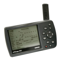
Explains the function of each button on the GPSMAP 162.

Selecting Options

Entering Data

Initializing the Receiver

Powering On and Acknowledging Warnings

Guides on turning on the unit and acknowledging safety messages.

Graphical Initialization

Acquiring Satellite Fix

Explains how the unit finds and locks onto satellites for positioning.

Power On and Screen Adjustment

Backlighting and Simulator Mode

Entering Simulator Mode

Guides users on how to activate the simulator for practice.

Using the Map Cursor

Marking Waypoints

Creating and Naming Waypoints

Guides on marking current location and naming waypoints.

Navigating to a Destination

Using the NAV/MOB Key

Explains the primary functions of the NAV/MOB button for navigation.

Simulated Tour

Waypoint Review and Creation

Creating Waypoints from Map

Guides on creating waypoints directly on the map display.

Compass and Highway Navigation

Highway Page Functionality

Track Log Management and Power Off

Status Page

Satellite Acquisition Status

Explains the different stages of acquiring satellite signals.

Status Page Details

Status Page Options

Status Page Menu Options

Map Page Overview

Using the Map Page Display

Explains the map display, its data, and operating modes.

Map Page Cursor Control

Interacting with Map Items

Waypoint Information and Creation

Creating Waypoints from Map Items

How to create waypoints based on map features.

Map Scaling and Waypoint Creation

Map Page Options

Map Display Configuration

Map Setup Menu Options

Page Layout and Data Fields

Customizing Data Fields

Selecting specific data to display in fields.

Data Field Options

Compass Page

Highway Page

Highway Page Options

Creating and Using Waypoints

Waypoint Creation Methods

Describes methods like using the ENTER/MARK key for waypoint creation.

Graphical Waypoint Creation

Creating Waypoints from Map Display

How to create waypoints using the map cursor.

Waypoint Entry and Editing

Reviewing and Editing Stored Waypoints

How to modify existing waypoints.

Editing Waypoint Attributes

Waypoint Management Submenus

Waypoint List Navigation and Deletion

Deleting Waypoints

Methods for removing waypoints from the unit.

Nearest and Proximity Waypoints

Proximity Waypoint Management

Adding a Proximity Waypoint

How to set up a waypoint for proximity alerts.

Proximity Alarms and Destination Navigation

Navigating to a Destination

Explains how to set and follow a destination.

Initiating Navigation

Selecting 'Go To' Graphically from Map

Choosing a destination directly on the map.

TracBack Navigation

Using TracBack Navigation

Activating a TracBack Route

Following a previously recorded path.

Man OverBoard (MOB) Function

Activating the MOB Function

Quickly marking and navigating to a MOB position.

Creating Routes

Creating Routes via Text Entry

Step-by-step guide to creating routes using text.

Graphical Route Creation and Editing

Creating Routes on the Map Display

Building routes graphically on the map.

Route List Management

Route Review and Modification

Editing Routes on Map

Route Editing: Points and Removal

Route Management Features

Active Route Page

Main Menu Page

Track Log Management

Track Recording and TracBack Activation

Trip, Time, and Pages Settings

System Settings (Systm Tab)

Units Tab Configuration

Units of Measure and Heading Settings

Communications Tab (Comm)

DGPS Control and Status

Alarm Settings

Configuring Navigation Alarms

Setting alarms for Anchor Drag, Arrival, Off Course.

Celestial Data (Celest Tab)

Tide Information (Tide Tab)

Tide Data Search and Display

System Messages

System Message Explanations

Navigation Terms Glossary

Navigation Term Definitions (N-V)

Product Specifications

Physical and Performance Specifications

Details size, weight, display, receiver, and accuracy.

Antenna Installation

Mounting the GPS Antenna

Instructions for physically mounting the antenna.

Connecting the GPS Antenna Cable

Steps to connect the antenna to the unit.

Unit Installation

Mounting the GPSMAP 162 Display Unit

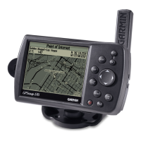
Guidance on selecting a location and mounting the main unit.

Wiring and Interfacing

Connecting Power and Data Cables

How to connect power and data to the unit.

Advanced NMEA Setup

Related product manuals