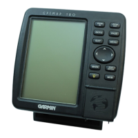
Do you have a question about the Garmin GPSMAP 182 and is the answer not in the manual?
Outlines critical safety warnings and precautions for using the device.
Steps to power on the unit and acknowledge the warning screen.
Details the graphical process to initialize the GPS position.
Detailed explanation of the Map Page, its features, and navigation.
Using the cursor to pan, select items, and zoom on the map.
Accessing and using the Map Page options menu.
Configuring Navaids, Nav Line, Track, and Other settings.
Detailed explanation of the Compass Page for steering guidance.
Setting up the Highway Page display options.
Basic methods for creating waypoints using the ENTER/MARK key.
Creating waypoints graphically from the map display.
Reviewing, renaming, and modifying existing waypoints.
Moving waypoints on the map and accessing waypoint submenus.
Displaying waypoint menus, reviewing lists, and deleting waypoints.
Activating a 'Go To' function from a point list or map.
Activating a 'Go To' from map items and clearing track logs.
Saving and activating a TracBack route to retrace paths.
Creating routes graphically from the Route Edit map page.
Creating routes using text from the Route Review page.
Activating, deactivating, copying, and deleting routes from the list.
Reviewing and modifying routes, entering custom names.
Instructions for mounting the GA 29 remote antenna.
Mounting the GPSMAP 182/182C/232 unit with a gimbal bracket.
Flush mounting procedures for the GPSMAP 182/182C/232 unit.
Connecting power/data cables and interfacing details.
| display size | 5.5" diagonal (14.0 cm) |
|---|---|
| display type | high-resolution, 10-level grayscale LCD with backlighting |
| display resolution | 240 x 360 pixels |
| power source | 8-35v DC |
|---|---|
| power usage | 4 watts max. at 13.8v DC |
| temperature range | 5ºF to 158ºF (-15ºC to 70ºC) |
|---|---|
| case | Fully gasketed, high impact plastic alloy, waterproof to IEC 529 IPX7 standards |
| antenna | GA 29 remote marine mount with 30' cable or bail mount antenna |
| receiver | WAAS enabled, 12 parallel channel GPS receiver |
|---|---|
| acquisition time (warm) | Approximately 15 seconds |
| acquisition time (cold) | Approximately 45 seconds |
| width | 6.3" |
|---|---|
| height | 6.2" |
| depth | 2.6" |
| weight | 1.7 lbs. (.77 kg) |
| display size | 7.1" diagonal (18.0 cm) |
|---|---|
| display type | high-resolution, 10-level grayscale LCD with backlighting |
| display resolution | 240 x 360 pixels |
| power source | 8-35v DC |
|---|---|
| power usage | 4 watts max. at 13.8v DC |
| temperature range | 5ºF to 158ºF (-15ºC to 70ºC) |
|---|---|
| case | Fully gasketed, high impact plastic alloy, waterproof to IEC 529 IPX7 standards |
| antenna | GA 29 remote marine mount with 30' cable |
| receiver | WAAS enabled, 12 parallel channel GPS receiver |
|---|---|
| acquisition time (warm) | Approximately 15 seconds |
| acquisition time (cold) | Approximately 45 seconds |
| width | 7.7" |
|---|---|
| height | 7.5" |
| depth | 2.6" |
| weight | 2 lbs. (.91 kg) |